Barn Record Southington
RETURN TO ‘FIND BARNS’- Building Name (Common)
- William H. and Lucretia Stow Cummings House
- Building Name (Historic)
- William H. and Lucretia Stow Cummings House
- Address
- 28 Elm Street, Southington
- Typology

- Overview
-
Designations
Historic Significance
Architectural description:
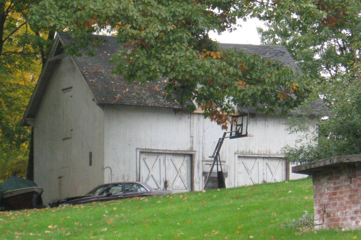
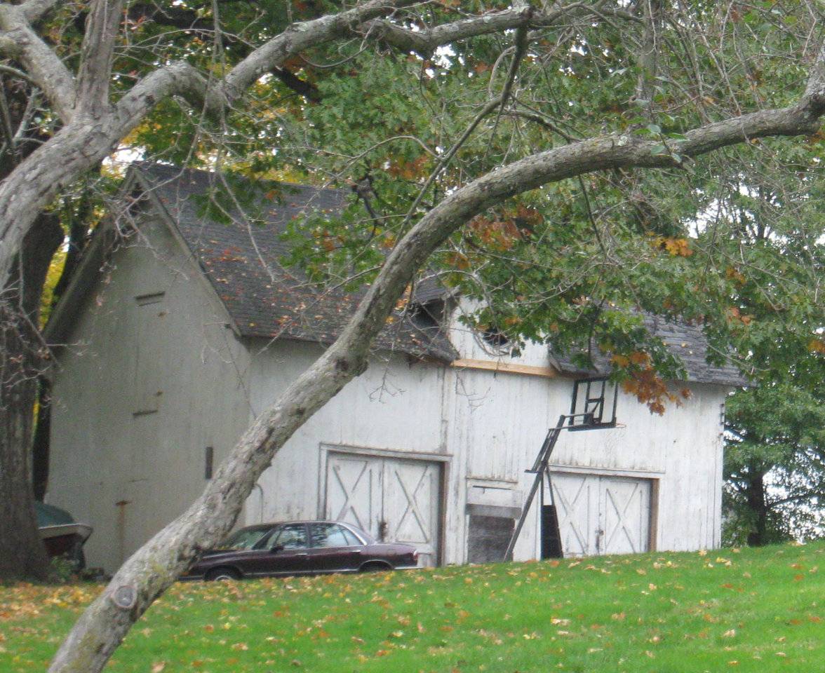
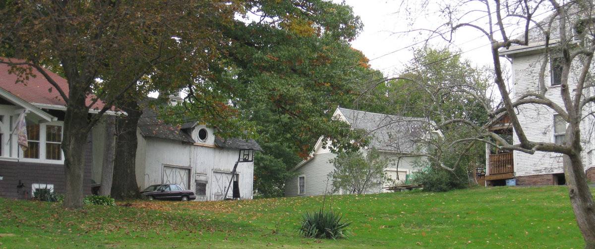
This is a 1 1/2-story gable-roofed structure with its ridge-line oriented north-south. The entry facade is the east eave-side, where there are two wide door openings with pairs of interior sliding doors paneled with stick-style cross bracing. Between the large doors there is a single pass-through door. Above the door is a narrow wall dormer with an oculus window. The south gable end has a pass-through door at grade and a hay door above. The gable roof has overhangs with some extant trim in the south gable, including a stick-style collar brace and some sawn scroll-work ornament along the rake near the peak.
Roofing is asphalt shingles; there is a louvered cupola on the ridge. Siding is vertical flush-board painted white or gray.
Historical significance:Until the 1830s, the horses used for riding and driving carriages were often kept in the main barn along with the other farm animals. By the 1850s, some New England farmers built separate horse stables and carriage houses. Early carriage houses were built just to shelter a carriage and perhaps a sleigh, but no horses. The pre-cursors to the twentieth-century garage, these outbuildings are distinguished by their large hinged doors, few windows, and proximity to the dooryard.
The combined horse stable and carriage house continued to be a common farm building through the second half of the nineteenth century and the first decade of the twentieth century, until automobiles became common. Elaborate carriage houses were also associated with gentlemen farms and country estates of the late 19th and early 20th centuries. Another form of carriage barn, the urban livery stable, served the needs of tradespeople.
Historical background:The Plantsville Historic District, located in Southington, Connecticut, encompasses approximately 116 acres. Formerly known as “Pearl’s Corners,” Plantsville developed at the junction of roads leading from Farmington to Waterbury and from Bristol to New Haven (present day Main, South Main, and West Main Streets). The district contains a mixture of industrial, commercial, and residential architecture.
At the center of the district are several industrial complexes that were home to Southington’s prosperous hardware industry, which flourished in the mid-to-late nineteenth century. Plantsville’s identity as an industrial center began to take shape in 1842 when the Plant Brothers, A.H. Plant and E.M. Plant harnessed the water power of the Quinnipiac River to operate a factory for the manufacture of carriage bolts.
Manufacturing buildings are located along the Quinnipiac River and Penn Central Railroad (formerly the New Haven and Northhampton Railroad, now the Farmington Canal Trail) that bisects the district and along the Eight Mile River that runs through the western edge of the district. A strip of commercial architecture runs east-west along Main and West Main Streets, connecting the district’s two main residential concentrations. These areas are centered on Church Street and on Grove Street. A substantial strip of residential architecture also extends northward along Summer Street (formerly Water Street) near the course of the Quinnipiac River (Lewis, 1988).
Field Notes
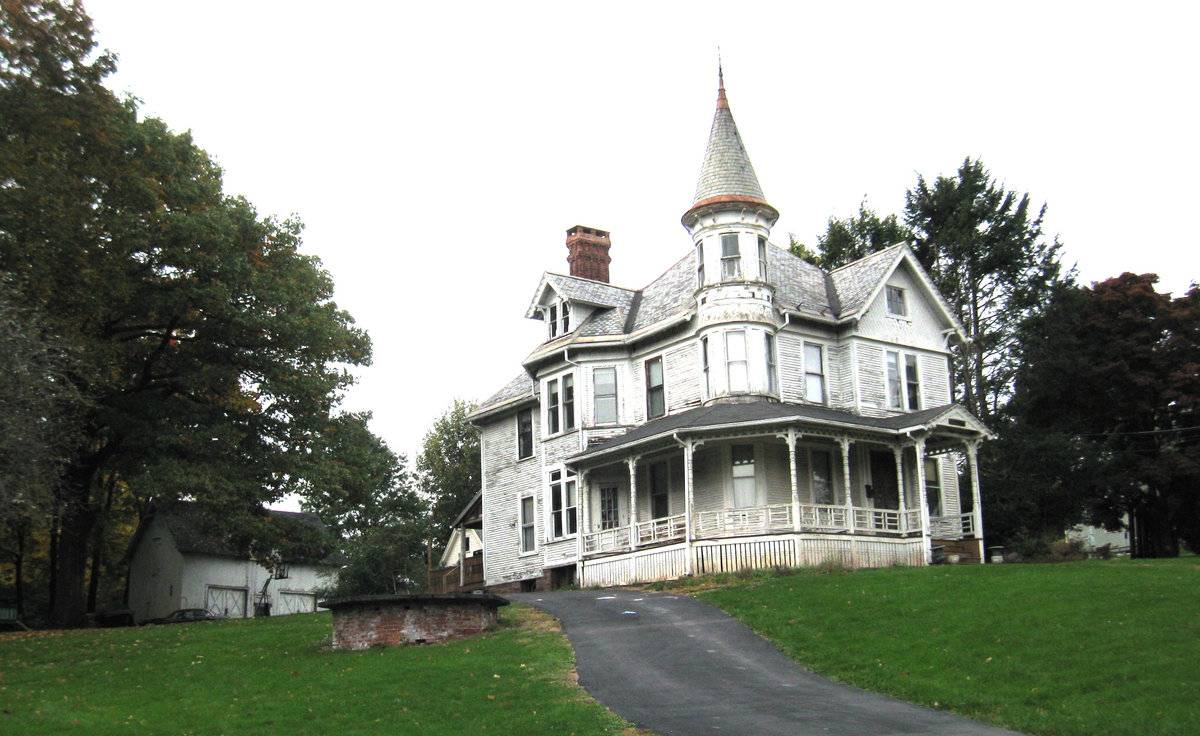
Contributing resource in the Plantsville Historic District. Queen Anne style mansion and carriage barn, c. 1890.
- Use & Accessibility
Use (Historic)
Use (Present)
Exterior Visible from Public Road?
Yes
Demolished
n/a
Location Integrity
Unknown
- Environment
Related features
Environment features
Relationship to surroundings
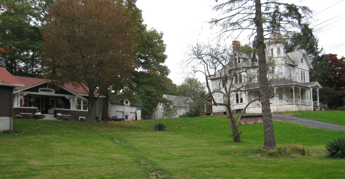
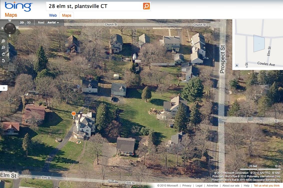
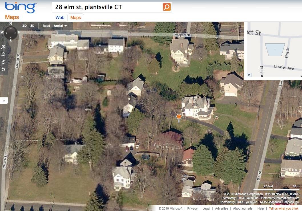
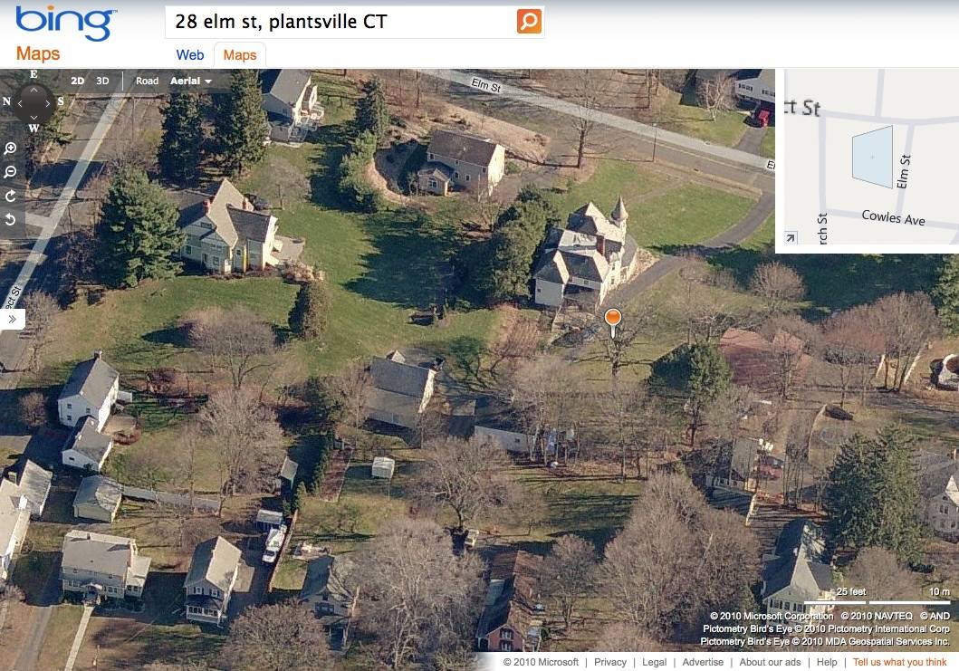
This carriage barn is located on a hill behind, to the west of, its associated house, a large Queen Anne mansion in the Plantsville Historic District. The barn is reached by a curving drive up from Elm Street past the mansion, or alternatively by a drive from Church Street to the west. An early 20th-century garage for a house at 90 Prospect Street sits adjacent to the north, apparently utilizing the same access drive from Church Street.
The neighborhood consists of some streets of densely-developed 19th- and early-20th-century homes, while other blocks have larger lots like this .83-acre parcel, with substantial mansions of the mill owners of Planstville’s period of industrial prosperity. Many of the large lots have been further subdivided and infill construction added, as with the 20th-century bungalow next door at 38 Elm Street.- Typology & Materials
-
Building Typology
Materials
Structural System
Roof materials
Roof type
Approximate Dimensions
28 x 36 feet
- Source
-
Date Compiled
10/26/2010
Compiled By
Charlotte Hitchcock, reviewed by CT Trust
Sources
Field notes and photographs by Charlotte Hitchcock 10/21/2010.
Aerial views from
http://www.bing.com/maps/ accessed 10/26/2010.Town of Southington Assessor’s Record and GIS viewer - Parcel ID 074045
Lewis, Barbara, Andrews, Gregory, Plantsville National Register District Nomination No. 88002673, National Park Service, 1988.
Sexton, James, PhD, Survey Narrative of the Connecticut Barn, Connecticut Trust for Historic Preservation, Hamden, CT, 2005, http://www.connecticutbarns.org/history.
Visser, Thomas D., Field Guide to New England Barns and Farm Buildings, University Press of New England, 1997.
- PhotosClick on image to view full file
-