Barn Record Branford
RETURN TO ‘FIND BARNS’- Building Name (Common)
- Wyllys Russell Homestead
- Building Name (Historic)
- Wyllys Russell Homestead
- Address
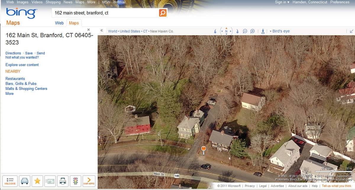
- 162 Main Street (Rte 146), Branford
- Typology
- Overview
-
Designations
Historic Significance
Architectural description:
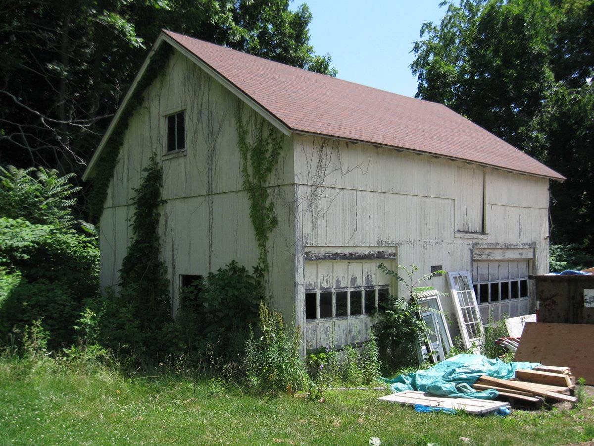
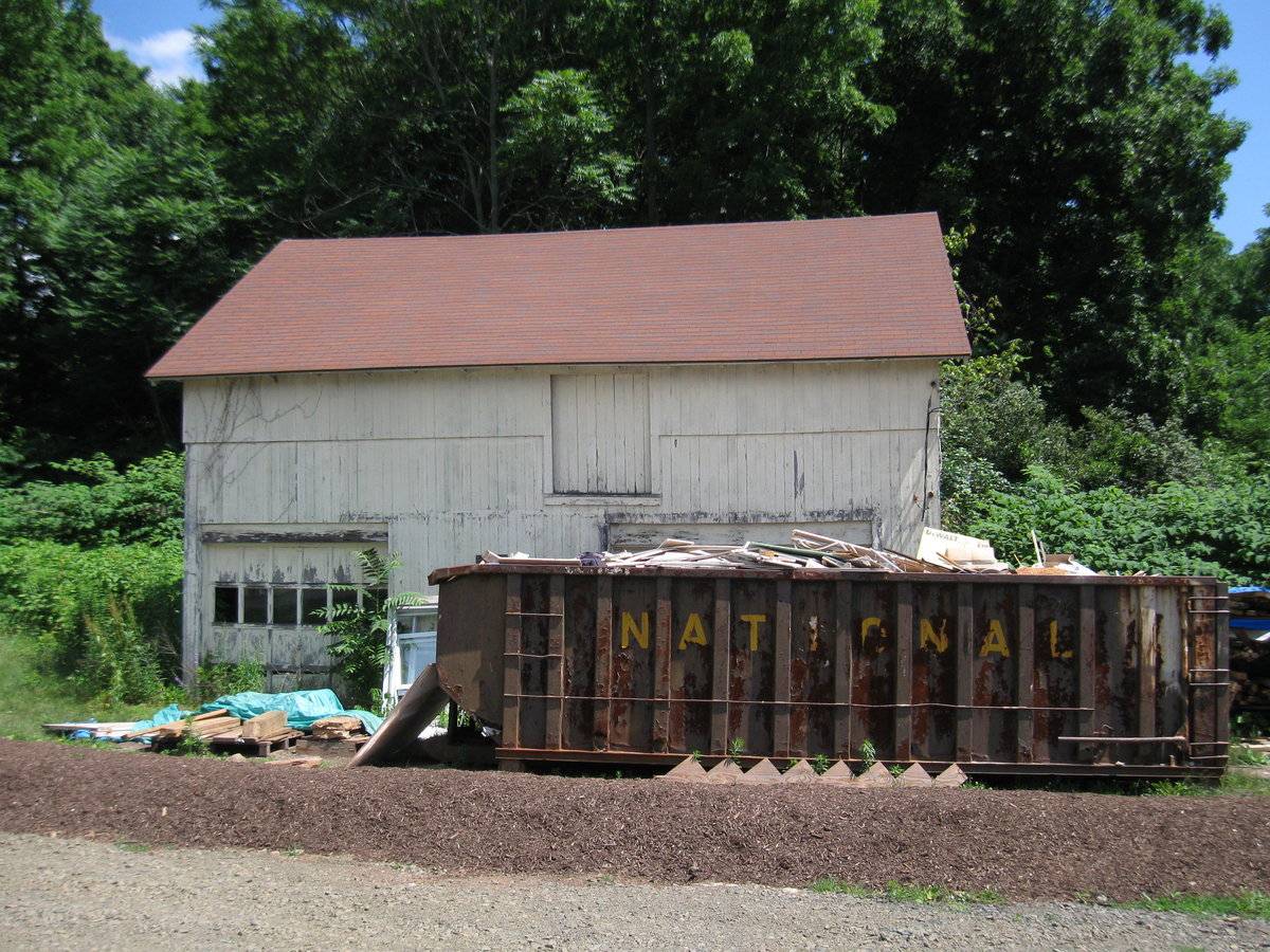
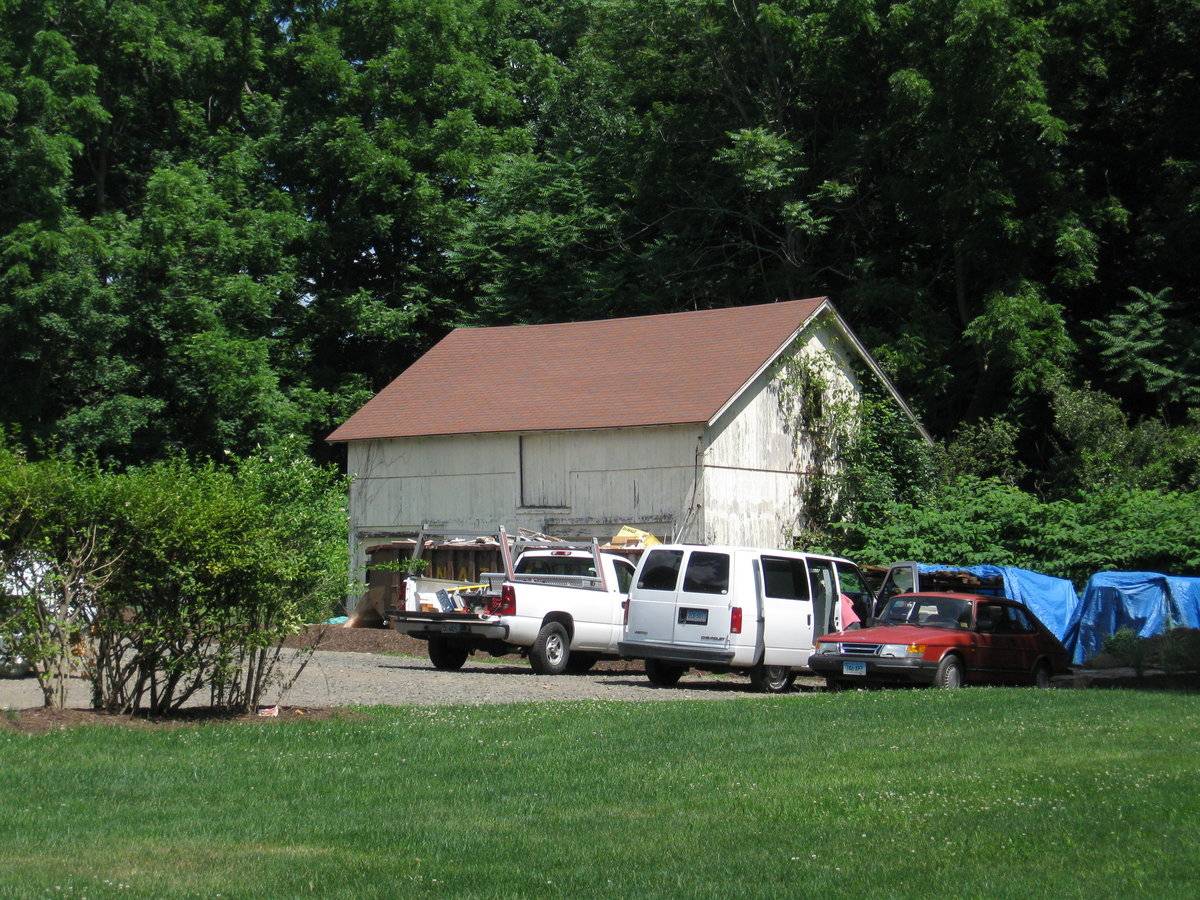
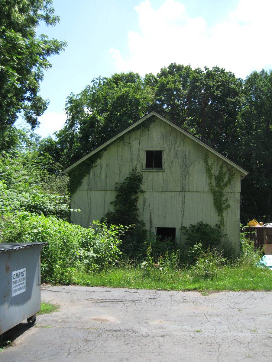
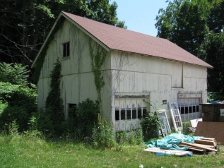
The barn is a 1 ½-story, gable-roof rectangular structure. The roof ridge is aligned east-west and extends approximately parallel to the course of the public road. Based on its general form (height and relatively steep roof pitch) and the presence of a loft entry, it apparently represents a carriage house or small barn that was renovated in the 20th century for use as a garage.
The principal façade is the south eave wall. There are two garage bay entries on this wall, positioned at either corner, fitted with overhead garage doors of twenty-four-panel design with window panes composing the second row of panels. On the upper story there is a loft entry that is fitted with a wooden door and located off-center on the eastern half of the wall.
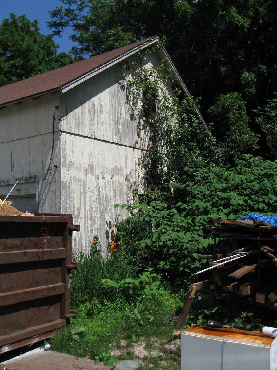
The west gable-end wall has a centrally positioned window opening on the ground story and a two-pane fixed-sash window on the gable attic.
The east gable-end wall also has one center window opening on the ground story and one in the gable-attic.
The foundation is not readily observable. The barn is clad in vertical flush-board siding painted yellow, and roofed with asphalt shingle. The roof overlaps the eaves by about one to two feet, supported by exposed rafter ends.
Historical significance:Until the 1830s, the horses used for riding and driving carriages were often kept in the main barn along with the other farm animals. By the 1850s, some New England farmers built separate horse stables and carriage houses. Early carriage houses were built just to shelter a carriage and perhaps a sleigh, but no horses. The precursor to the twentieth-century garage, these outbuildings are distinguished by their large hinged doors, few windows, and proximity to the dooryard. The combined horse stable and carriage house continued to be a common farm building through the second half of the nineteenth century and the first decade of the twentieth century, until automobiles became common. Elaborate carriage houses were also associated with gentleman farms and country estates of the late 19th and early 20th centuries. Another form of carriage barn, the urban livery stable, served the needs of tradespeople.
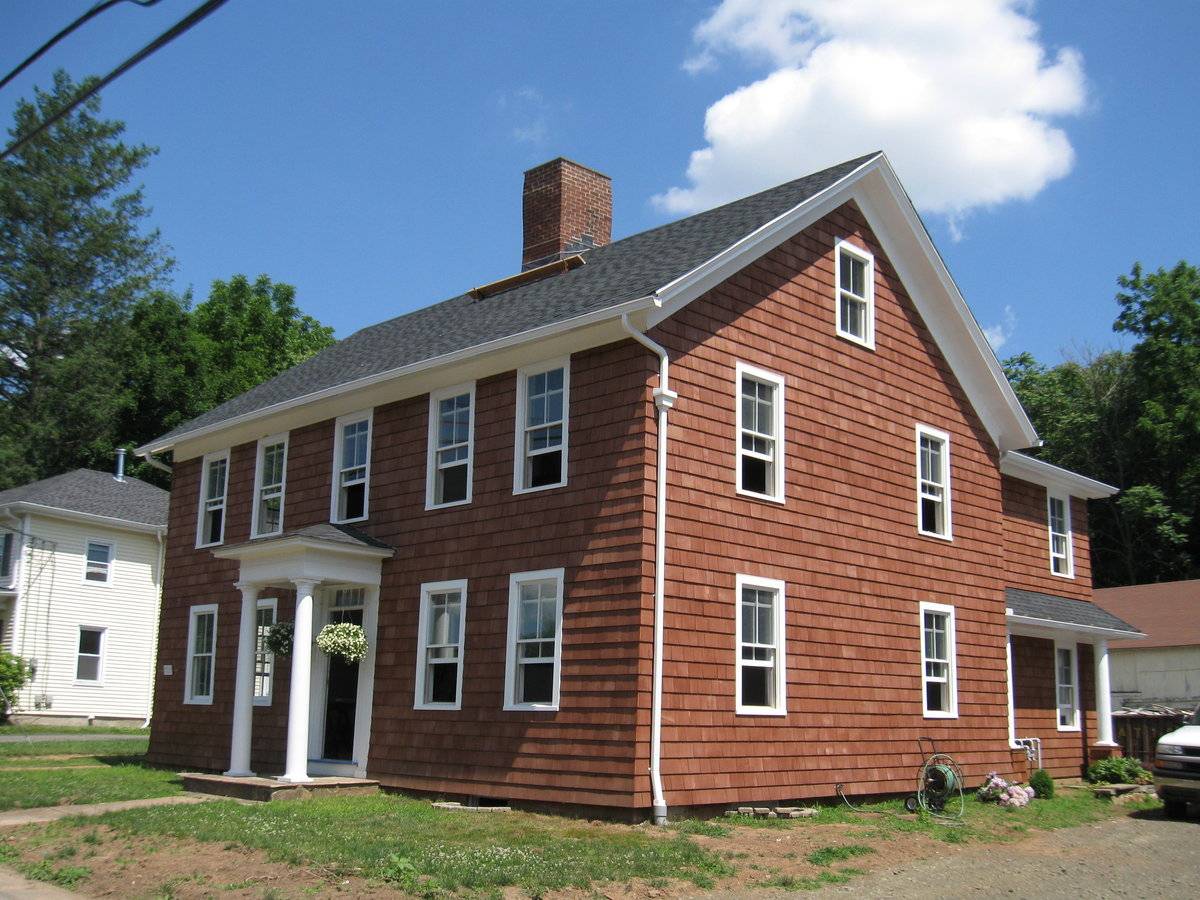
Historical background:This property is part of the National Register of Historic Places Canoe Brook Historic District. The Willis Russell House was built ca. 1820. The barn was built c. 1870.
“The early history of Branford was tied to the fortunes of New Haven, which was settled in 1638 by Theophilus Eaton and the Reverend John Davenport. When the New Haven Colony was organized in 1643, it included the towns of Stamford, Milford, Guilford and Southhold, Long Island. In 1644, upon the invitation of New Haven, a group of 40 families from Wethersfield led by William Swaine arrived to found the new town of Branford, which became part of the New Haven Colony that same year. Land for Branford, which was purchased from the Mattabeseck tribe, encompassed a large tract that ran from New Haven on the west and Guilford on the east, and extended ten miles north from the coast to include present-day North Branford. The original settlement, however, today’s Branford Center, was concentrated near the coast just north of the Branford River estuary, a natural harbor. In 1645, when Southhold switched its allegiance to the Connecticut Colony, a group of dissenters there led by the Reverend Abraham Pierson came to Branford. Believing that only church members should have a vote in civil elections, they had a fundamental disagreement with Connecticut’s more liberal suffrage policies. Although both colonies were theocracies, with an established Congregational Church, Connecticut’s voters (then, of course, only adult males) were qualified by property ownership. This issue resurfaced in 1666, when under the colonial charter granted by King Charles II, New Haven and Connecticut merged into a single colony. At that time a disgruntled Pierson left Connecticut, taking his followers to New Jersey, where they founded Newark. Despite this loss, Branford continued to grow and flourish. Blessed with fertile farmland and the best harbor between New Haven and New London, the town achieved a well-established coasting trade by the end of the seventeenth century. In fact, by then, Branford Center had become so crowded, the second and third generation began to take up land that had been divided among the Branford proprietors to the north and west.”“Two center-chimney Colonials were built about 1820. The one erected by Timothy Bradley, Jr., at the west end of Bradley Street has an Italianate portico. The other example, the Wyllys Russell House on Main Street, has a four-pane transom over the door and a hipped-roof Greek Revival portico. As indicated by the width of the overhang, the roof has been replaced.”
(Cunningham, Jan)
Field Notes
n/a
- Use & Accessibility
Use (Historic)
Use (Present)
Exterior Visible from Public Road?
Yes
Demolished
n/a
Location Integrity
Unknown
- Environment
Related features
Environment features
Relationship to surroundings
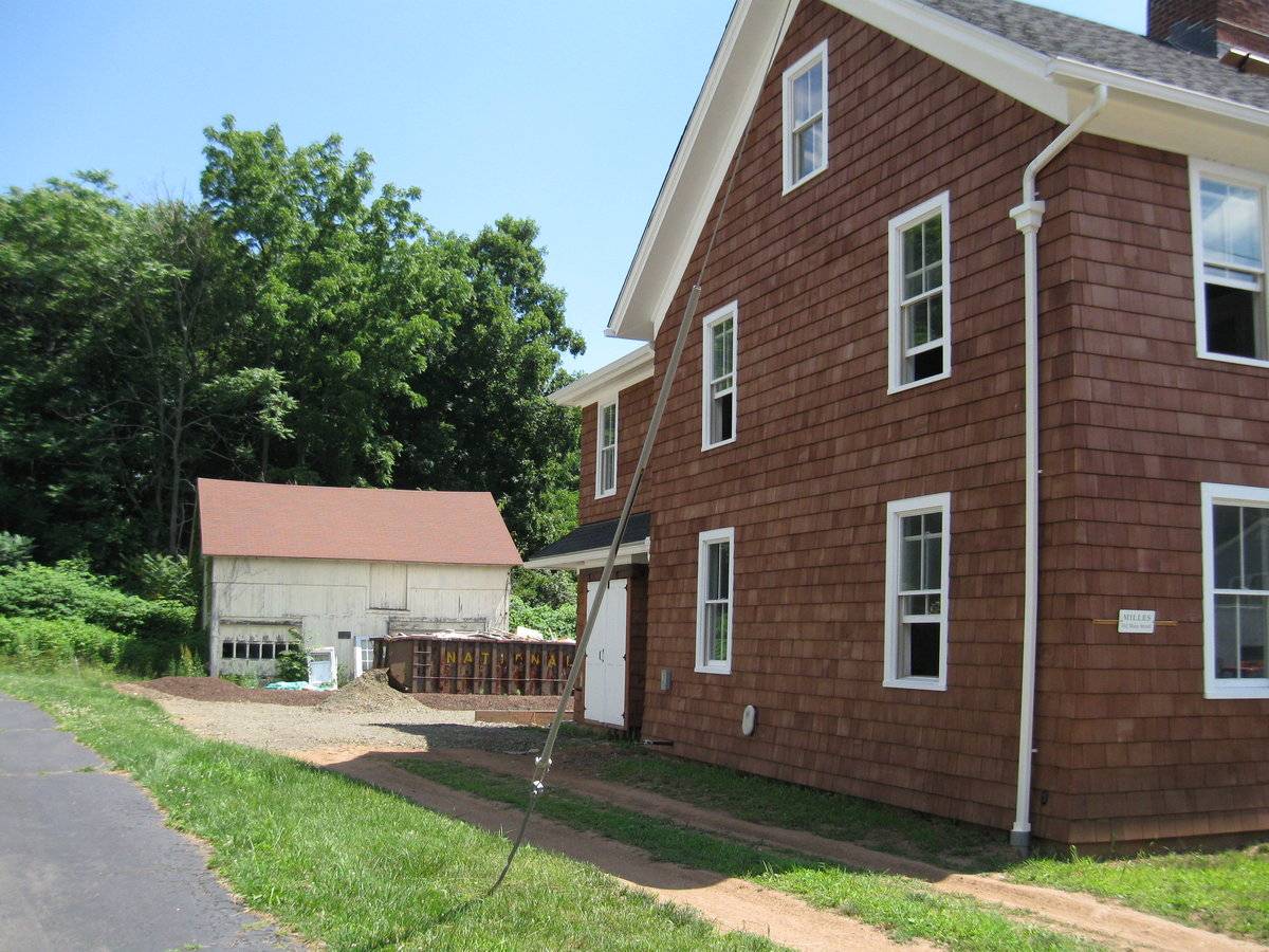
The property is located on the north side of Main Street (Route 146) in the historic central area of the Branford Center, situated about 1,000 feet east of the junction with US Route 1. The general character of the near vicinity is that of a low-density, mixed residential and commercial urban neighborhood in the town center of a suburban town near New Haven.
The property, approximately one-half (0.5) acre in extent, consists of a rectangular lot fronting on Main Street. There are two buildings on the property, the dwelling and the carriage house. The house is set back from streetside by about 30 feet with a strip of lawn in front. Sidewalk is absent on the north side of the street. The carriage house is situated about 80 feet behind the house. The historic dwelling is flanked by gravel lanes that give access to the gravel and grass parking area that occupies the area intervening between the two buildings. A wooded area is located to the rear of the barn. Hardwood trees are interspersed along the west and east edges of the lot.
- Typology & Materials
-
Building Typology
Materials
Structural System
Roof materials
Roof type
Approximate Dimensions
600 square feet.
- Source
-
Date Compiled
04/10/2011
Compiled By
P. Pendleton & T. Levine, reviewed by CT Trust
Sources
Field notes and photographs by Leah Beckett date 8/17/2010.
Town of Branford Tax Assessor Record:
http://data.visionappraisal.com/BranfordCT/DEFAULT.asp
Parcel ID: D07/000 013/ 00002Aerial Mapping:
http://www.bing.com/maps accessed 4/10/2010.Cunningham, Jan. Canoe Brook Historic District, National Register of Historic Places Nomination No. 348884 Item No. 02000335 NRIS (National Register Information System), 2002.
http://nrhp.focus.nps.gov/natregsearchresult.do?fullresult=true&recordid=9Sexton, James, PhD, Survey Narrative of the Connecticut Barn, Connecticut Trust for Historic Preservation, Hamden, CT, 2005, http://www.connecticutbarns.org/history.
Visser, Thomas D., Field Guide to New England Barns and Farm Buildings, University Press of New England, 1997.
- PhotosClick on image to view full file
-