Barn Record Guilford
RETURN TO ‘FIND BARNS’- Building Name (Common)
- Samuel Evarts Farmstead
- Building Name (Historic)
- Samuel Evarts Farmstead
- Address
- 420 Nut Plains Road, Guilford
- Typology

- Overview
-
Designations
Historic Significance
Architectural description:
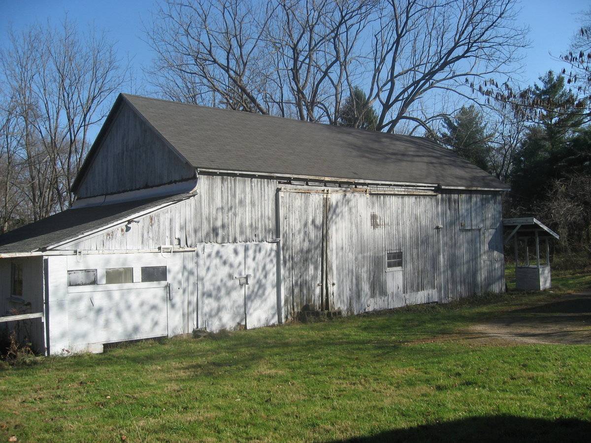
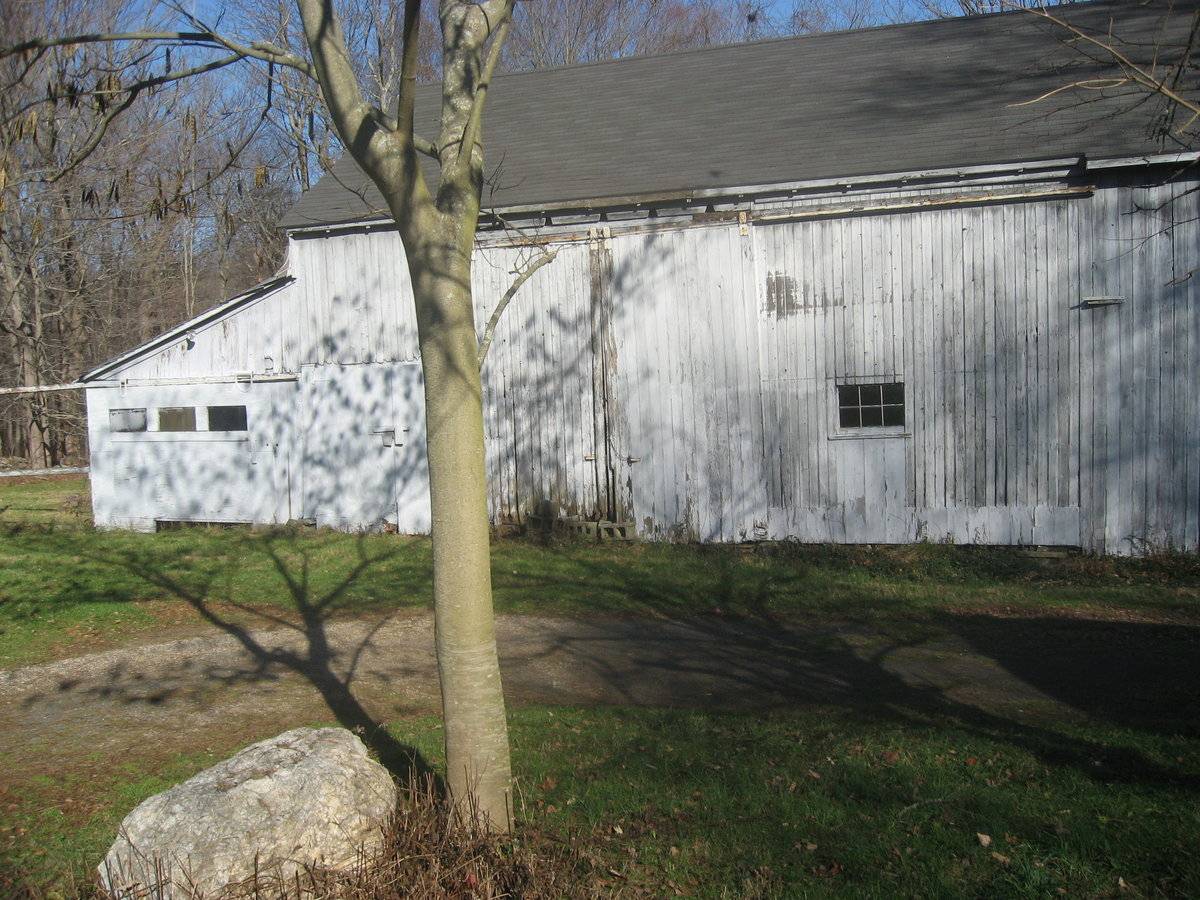
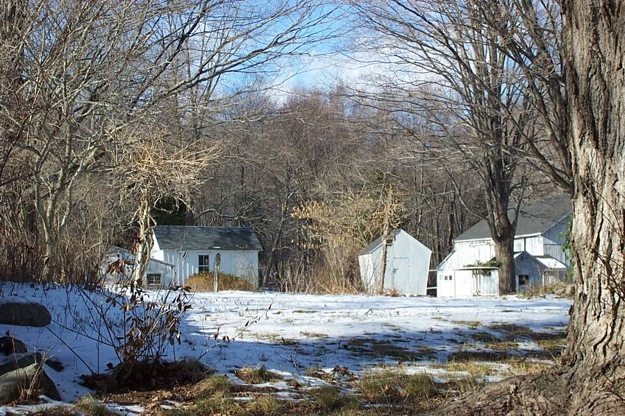
This is a 1 ½-story four-bay gable-roofed side- or eave-entry barn with two additions. The main facade faces southwest and the ridge-line runs northwest-southeast, which is approximately perpendicular to Nut Plains Road at this point. The main entrance is a pair of full-height sliding doors located in the second bay from the left in the southwest eave-side. In the bay immediately to the right of the entrance is a six-pane stable window on the first-story. A swinging-hinged hay door is located east of the window in the right end bay at the loft level. Left of the entrance is a pair of shorter swinging-hinged doors. A 1 ½-story shed-roofed addition is attached on the northwest gable-end and encompasses the full width of the original barn. The southwest side of the addition, flush with the main barn’s eave-side, has a sliding door with a band of three single-pane windows.
The northwest end of the addition has two six-pane stable windows, located near the corners. The gable attic of the original barn above the addition is blank. The northeast side of the addition has a window centered on it.
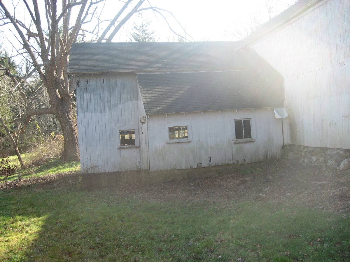
A 1 1/2-story ell addition is located on the northeast eave-side of the barn near the left (east) corner. The addition covers approximately half of the northeast eave-side and has a gable roof that extends perpendicular to that of the main barn. The northwest side of the addition has a small shed-roof projection that covers approximately 2/3 of it. This shed-roof section has a two-pane window on its south half and a six-pane window on its north half. A one-pane window is located on the addition north of the shed-roof section. The northeast gable-end of the addition has a window on the west half of the first story and a window in the gable attic.
The southeast gable-end of the main barn appears to have a double-hung window off-center to the right in the gable attic. The eave-side of the north ell is flush with the gable-end on this side.
The barn is covered with vertical flush-boards, except for the shed-roof addition on the northwest end, which appears to be plywood. The roof is covered with asphalt shingles and has exposed rafter tails. The foundation of the original barn is unmortared fieldstone and the foundation of the northeast addition is concrete.
Historical significance:
The oldest barns still found in the state are called the “English Barn,” “side-entry barn,” “eave entry,” or a 30 x 40. They are simple buildings with rectangular plan, pitched gable roof, and a door or doors located on one or both of the eave sides of the building based on the grain warehouses of the English colonists’ homeland. The name “30 by 40” originates from its size (in feet), which was large enough for 1 family and could service about 100 acres. The multi-purpose use of the English barn is reflected by the building’s construction in three distinct bays - one for each use. The middle bay was used for threshing, which is separating the seed from the stalk in wheat and oat by beating the stalks with a flail. The flanking bays would be for animals and hay storage.
In this instance, a fourth bay appears to have been added at the southeast end of the main barn, resulting in the off-center location of the entry doors.
Field Notes
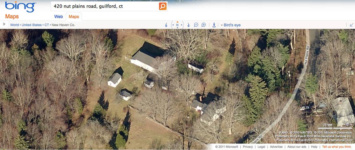
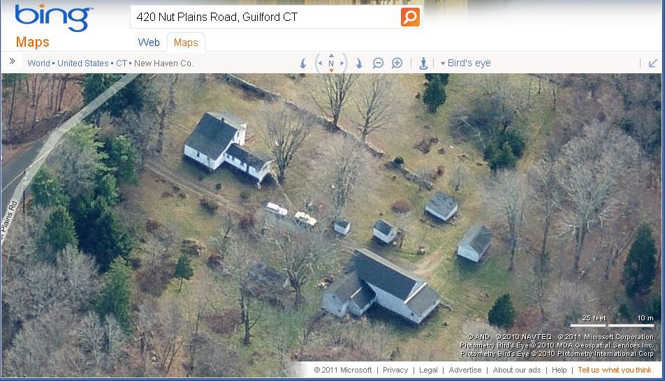
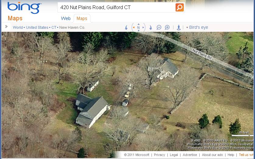
Listed on the State Register of Historic Places 9/04/2013. A sixth generation Evarts in the Nut Plains section of Guilford, Elizabeth Everts lives in her 19th century farmhouse. Her house and barn are dated 1885, and the barn has two additions. One addition originally belonged to neighbors who lived at 395 Nut Plains Rd.; part of their barn was moved to join the Evarts' barn. In addition to the barn, the barnyard consists of two chicken coops, a slaughter house, a milk house, and a corn crib, which was moved from elsewhere, and is the oldest structure on the property.
- Use & Accessibility
Use (Historic)
Use (Present)
Exterior Visible from Public Road?
1
Demolished
n/a
Location Integrity
Original Site
- Environment
Related features
Environment features
Relationship to surroundings
The barn is located northwest of the 1 1/2-story c. 1885 farmhouse it is associated with. The ridge-line of the house runs northwest-southeast,parallel to that of the barn and perpendicular to the road, which curves toward the north at this point. Fieldstone walls partially enclose the farmyard area on the northwest and southwest sides. Chicken coops are located east of the barn. Four other outbuildings are located southwest of the barn, including a slaughter house, a milk house, and a corn crib. The total size of the site is 35.9 acres. The surrounding area is residential and woodlands. This property is located along the east border of Guilford, north of I-95, in the less densely-populated part of the town.
Parcel ID: 086020.
- Typology & Materials
-
Building Typology
Materials
Structural System
Roof materials
Roof type
Approximate Dimensions
1,250 square feet
- Source
-
Date Compiled
02/10/2009
Compiled By
Beth Bjorklund & T. Levine, reviewed by CT Trust
Sources
Field notes and photographs by Ellie Green and Jane Montanaro, 02/10/2009
Town of Guilford Assessor’s Record or GIS Viewer:
http://www.guilfordgis.com/detail.asp?parid=086020
http://www.prophecyone.us/index_prophecy.php?town=Guilford
Parcel ID: 086020Aerial Mapping:
http://maps.google.com accessed
http://www.bing.com/maps accessedSexton, James, PhD, Survey Narrative of the Connecticut Barn, Connecticut Trust for Historic Preservation, Hamden, CT, 2005, http://www.connecticutbarns.org/history.
Visser, Thomas D., Field Guide to New England Barns and Farm Buildings, University Press of New England, 1997, 61.
- PhotosClick on image to view full file
-