Barn Record Kent
RETURN TO ‘FIND BARNS’- Building Name (Common)
- Marble Valley Farm - Kent Land Trust
- Building Name (Historic)
- Marble Valley Farm
- Address
- 170 Kent Road South (Rte 7), Kent
- Typology

- Overview
-
Designations
Historic Significance
Architectural description:
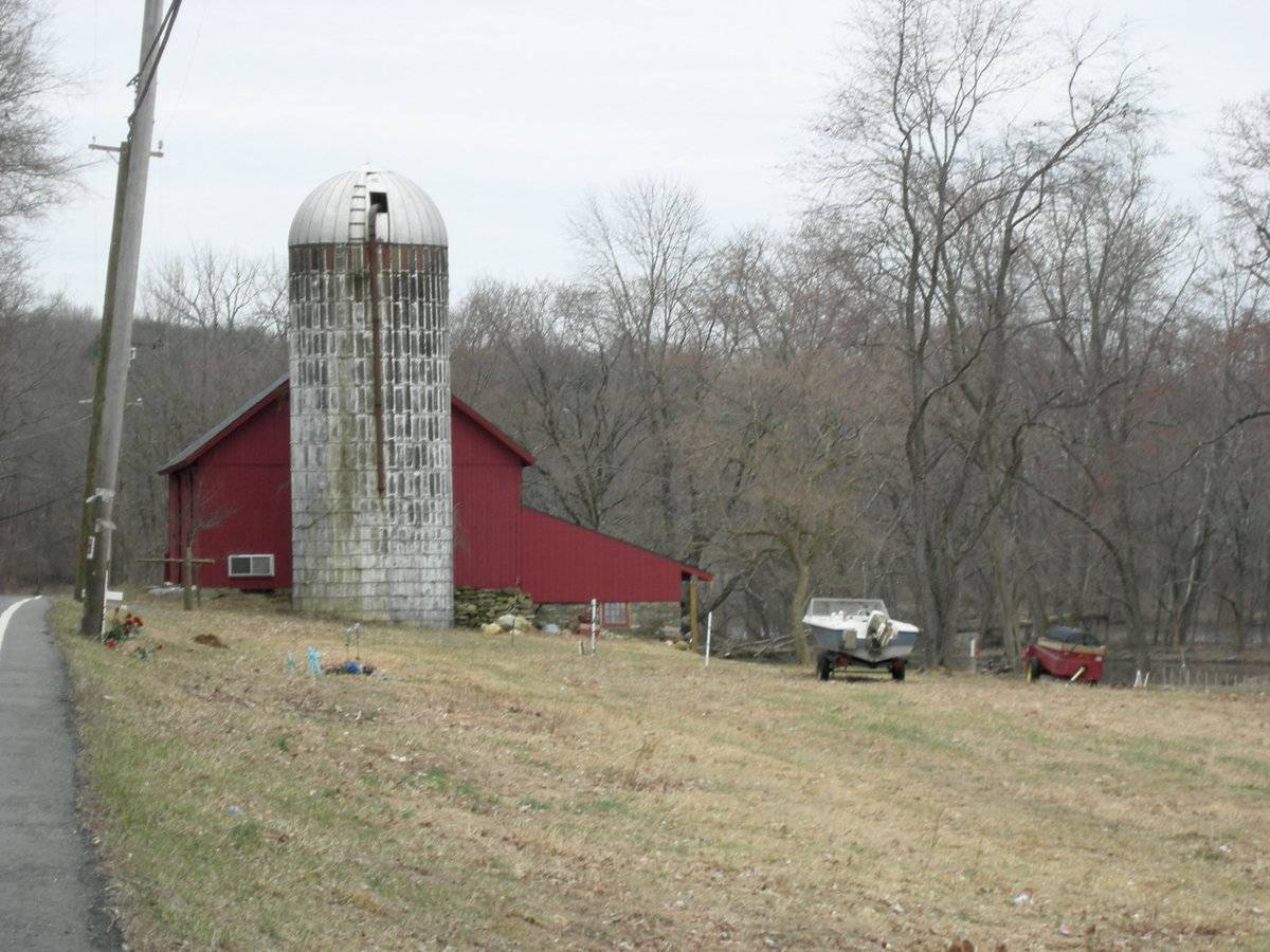
This is a 1 1/2-story extended English bank barn five bays in length, 30’ x 70’, with a shed-roofed addition and a lean-to. The main eave-side faces roughly east and the ridge-line of the barn is parallel to the road.
The barn has two main entries; two pairs of full-height exterior sliding doors on the east eave-side. The entries are in the second and fourth bays. The grade declines sharply at the south corner, revealing a basement level in the south gable-end of the barn. A stone retaining wall extends to the south. The south gable-end has a centered pair of hinged doors in the basement level. To the west is an exterior sliding door. A horizontal trim board separates the basement level from the main level. The rest of the southwest gable-side of the barn is blank except for an arch-topped louvered vent with trim beneath the apex of the roof and “The Kent Land Trust” logo in black paint, centered on the main level and gable attic. The south gable-end of a shed addition is flush with the south end wall and has a hinged door in its right half.
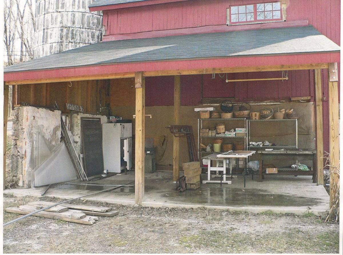
The west eave-side of the barn has the 1-story shed-roofed addition extending to the west at the right (south) corner of the side, covering one bay of the main barn, and an open lean-to extending to the west at the left (north) corner. Above the lean-to is a set of two six-pane windows. In the center bay area of the main block is a pair of sliding hinged hay doors on the main level and a metal-framed glazed opening at the basement level.
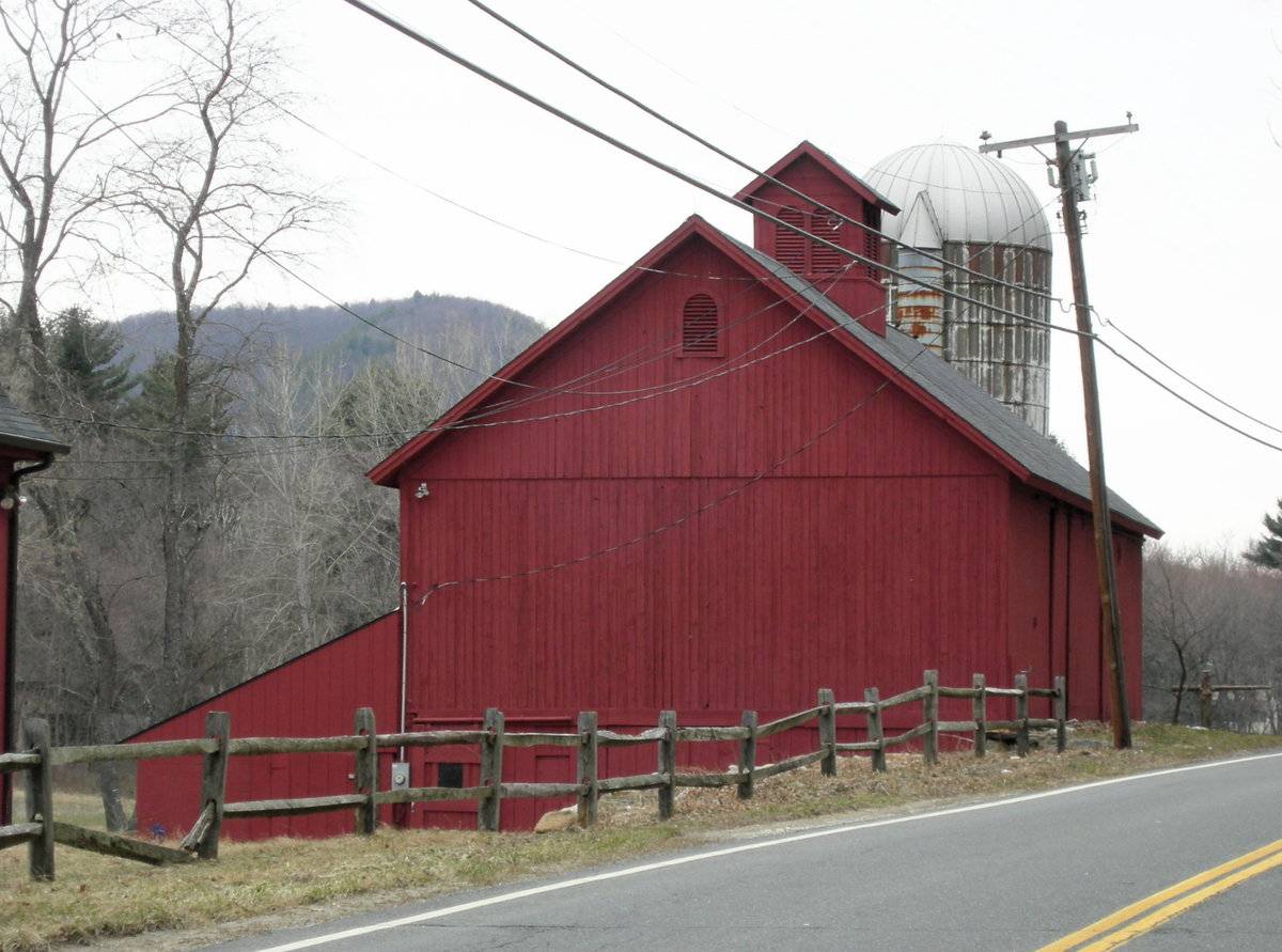
The grade at the north corner inclines to the main level. A foundation wall, of mortared fieldstone, extends to the northwest at the north corner and becomes the north wall of the lean-to. It has a nine-pane stable-type window set into the masonry, and a wood-sided gable-end above. Under the lean-to is a concrete floor slab. The northeast gable-end of the barn is blank except for a modern two-pane sliding window towards the east corner on the main level and an arched vent in the gable attic. The barn has vertical siding painted red. The gable roof has a projecting overhang and is covered with asphalt shingles. Centered on the ridge is a gable-roofed cupola with a pair of arch-topped louvered vents on each side. Adjacent to the north of the barn is a concrete stave silo with a domed metal roof and an attached chute enclosure on the south side. The silo appears to connect to the basement level of the barn below grade.
Historical significance:The oldest barns still found in the state are called the “English Barn,” “side-entry barn,” “eave entry,” or a 30 x 40. They are simple buildings with rectangular plan, pitched gable roof, and a door or doors located on one or both of the eave sides of the building based on the grain warehouses of the English colonists’ homeland. The name “30 by 40” originates from its size (in feet), which was large enough for 1 family and could service about 100 acres. The multi-purpose use of the English barn is reflected by the building’s construction in three distinct bays - one for each use. The middle bay was used for threshing, which is separating the seed from the stalk in wheat and oat by beating the stalks with a flail. The flanking bays would be for animals and hay storage.
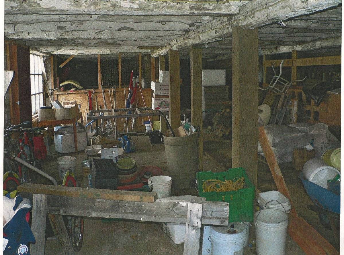
The 19th century saw the introduction of a basement under the barn to allow for the easy collection and storage of a winter’s worth of manure from the animals sheltered within the building. The bank barn is characterized by the location of its main floor above grade, either through building into a hillside or by raising the building on a foundation. This innovation, aided by the introduction of windows for light and ventilation, would eventually be joined by the introduction of space to shelter more animals under the main floor of the barn.
Field Notes
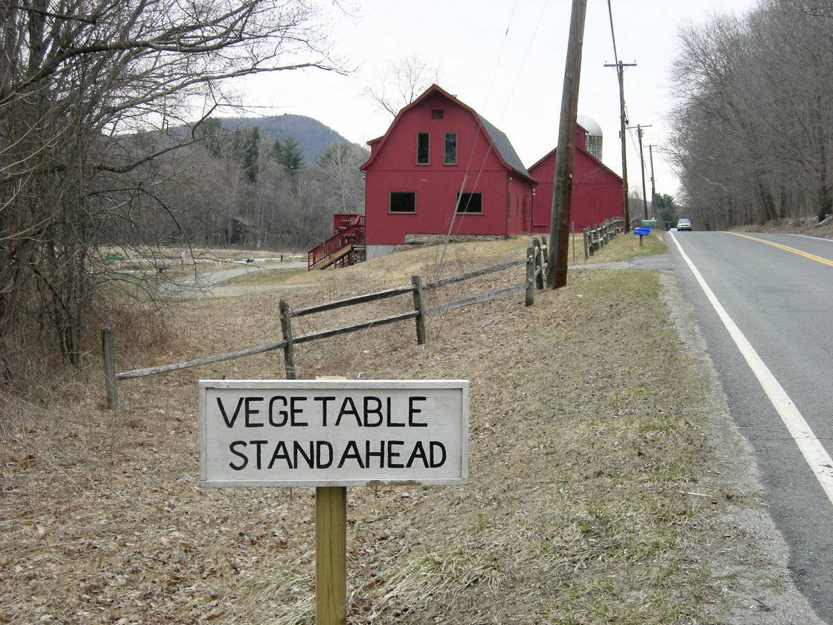
Listed on the State Register of Historic Places, 4/03/2014. Two barns and one barn with silo - on west side of Rte 7. Sign indicates the active vegetable farming on adjacent bottom land next to Housatonic River. The Kent Land Trust owns this farm which is operated organically as a CSA (Community Supported Agriculture). Sources: http://www.kentlandtrust.org/id6.html http://ctnofa.or/CSAs.htm
- Use & Accessibility
Use (Historic)
Use (Present)
Exterior Visible from Public Road?
Yes
Demolished
n/a
Location Integrity
Unknown
- Environment
Related features
Environment features
Relationship to surroundings
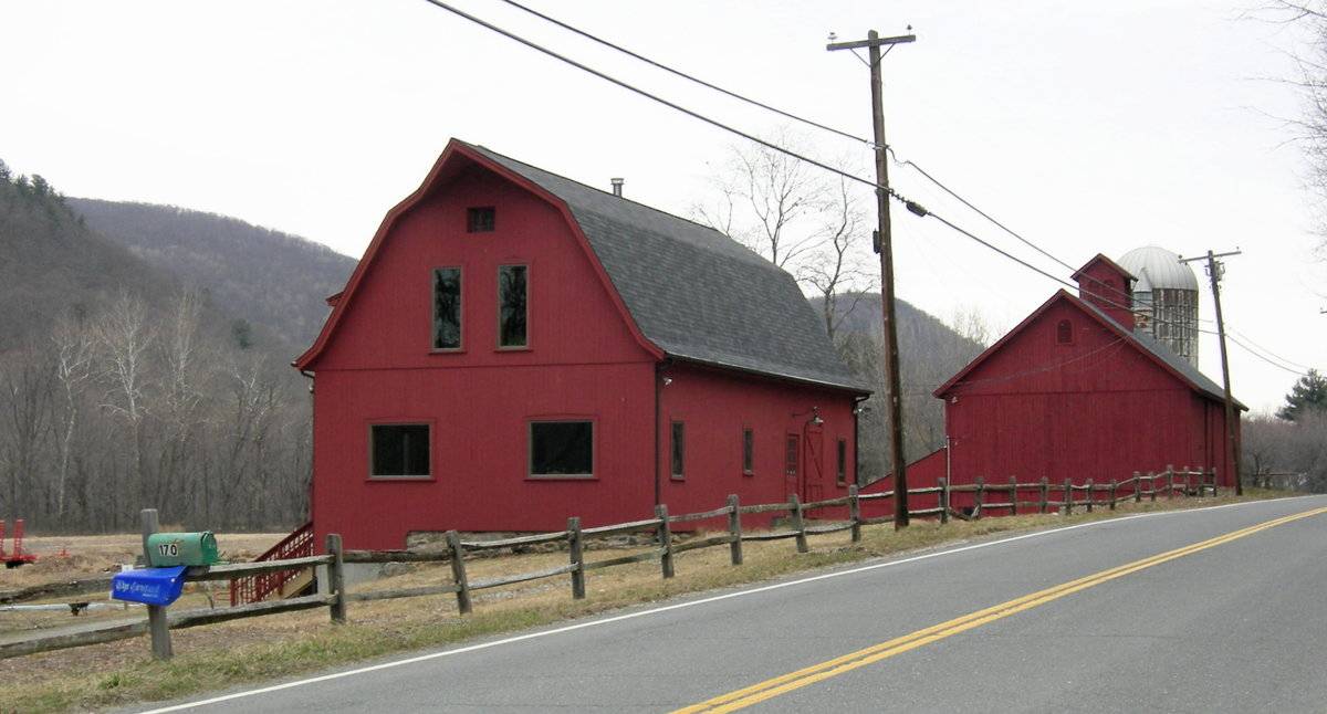
The site is located on the west side of Kent Road South (US Route 7) at the northern edge of the Bulls Bridge District of Kent (named for the 19th-century school district) and forms a striking southern gateway to the town of Kent. Two barns are located in a north-south line with their ridge-lines parallel to the road which runs slightly easterly of north-south as it heads toward Kent Village to the north. It appears that there was formerly a farmhouse located on the east side of the road and associated with the barns as the Carlson Farm.
The South Barn is used as a residence and the offices for the Kent Land Trust. The North Barn is used for agricultural purposes. Adjacent to the northeast of the Norht Barn is a concrete stave silo. To the southwest of the barn structures is a small parking lot, which is accessed by a gravel driveway further to the southwest. Both barns front Kent Road, although the North Barn is set closer to the road.
The South Barn residence is a 1 ½-story Dutch gambrel-roofed barn, approximately 30’ x 40’, with a banked basement level. Grade slopes down toward the west exposing the basement level. Mortared fieldstone foundations and some new concrete walls are visible on the north and south gable-ends. The main level and attic gable walls are vertical wood siding; a number of residential casement and picture windows are installed in the main level and attic gables. There is a porch and steps from an entry door in the west side, and another entry door in the east side off-center toward the right. The roof is asphalt shingles; there is a projecting hay hood in the south ridge of the roof and a shed dormer in the west pitch of the roof. A split-rail fence along the edge of the roadway borders the property adjacent to the South Barn.
To the west the site is bounded by the Housatonic River, with the grade sloping down into the river floodplain. To the north of the barns is a large planting area. The total size of the site is 14.22 acres. The area surrounding the site is scattered residential, active agriculture, open space and woodland on the hillside sloping up to the east.MBLU : 5/ 10/ 49/
- Typology & Materials
-
Building Typology
Materials
Structural System
Roof materials
Roof type
Approximate Dimensions
North Barn: 30' x 70' 1950 S.F. South Barn (residence) 27' x 49' 1350 sf
- Source
-
Date Compiled
11/12/2010
Compiled By
Todd Levine, reviewed by the Connecticut Trust
Sources
Photographs by Charlotte R. Hitchcock & Connie Manes.
Field notes by Charlotte R. Hitchcock.
Map of Kent, CT, retrieved on Novembe 11, 2010 from website www.zillow.com.
Sexton, James, PhD; Survey Narrative of the Connecticut Barn, Connecticut Trust for Historic Preservation, Hamden, CT, 2005, http://www.connecticutbarns.org/history.
Visser, Thomas D.,Field Guide to New England Barns and Farm Buildings, University Press of New England, 1997, 213 pages.
Vision Appraisal Online Database. www.visionappraisal.com/kentct.
- PhotosClick on image to view full file
-