Barn Record Guilford
RETURN TO ‘FIND BARNS’- Building Name (Common)
- Henry E. Parmelee Barn
- Building Name (Historic)
- Henry E. Parmelee Barn
- Address
- 814 Clapboard Hill Road, Guilford
- Typology

- Overview
-
Designations
Historic Significance
Architectural description:
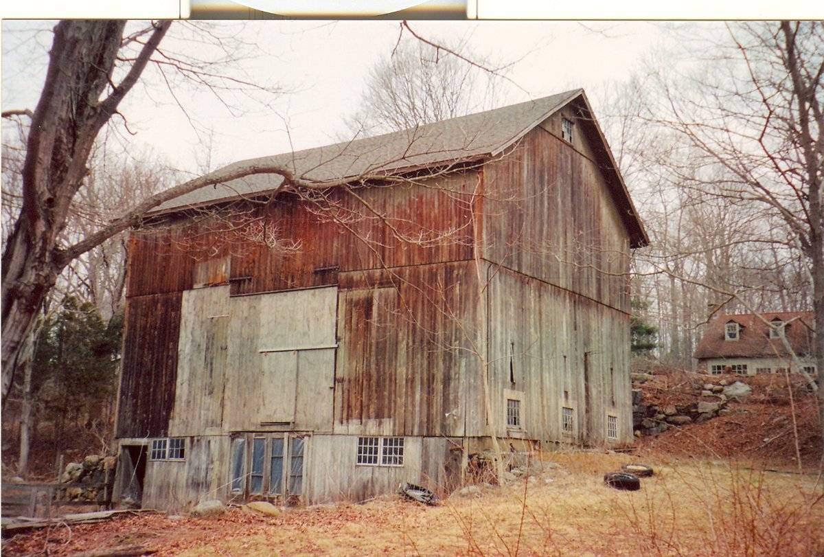
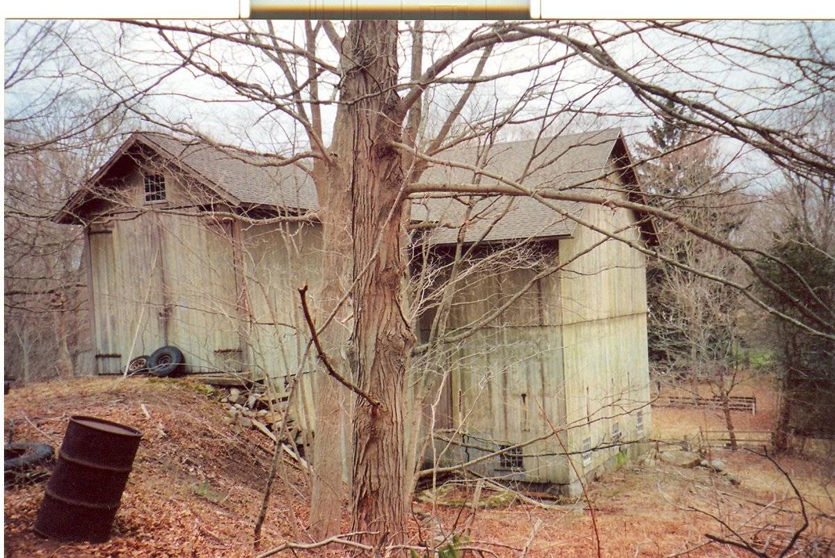
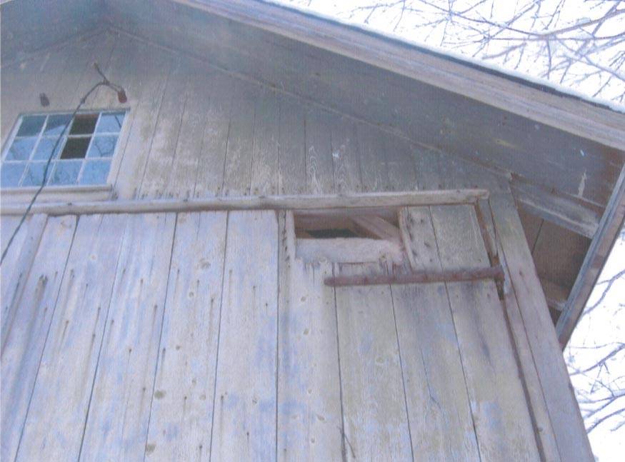
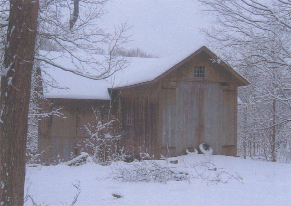
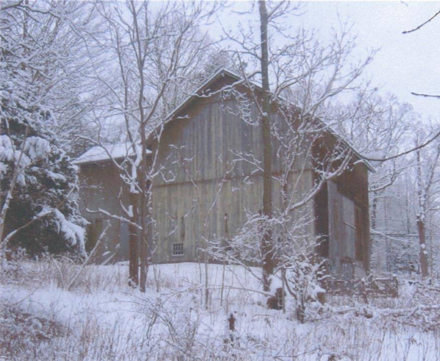
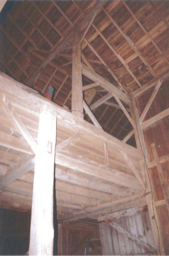
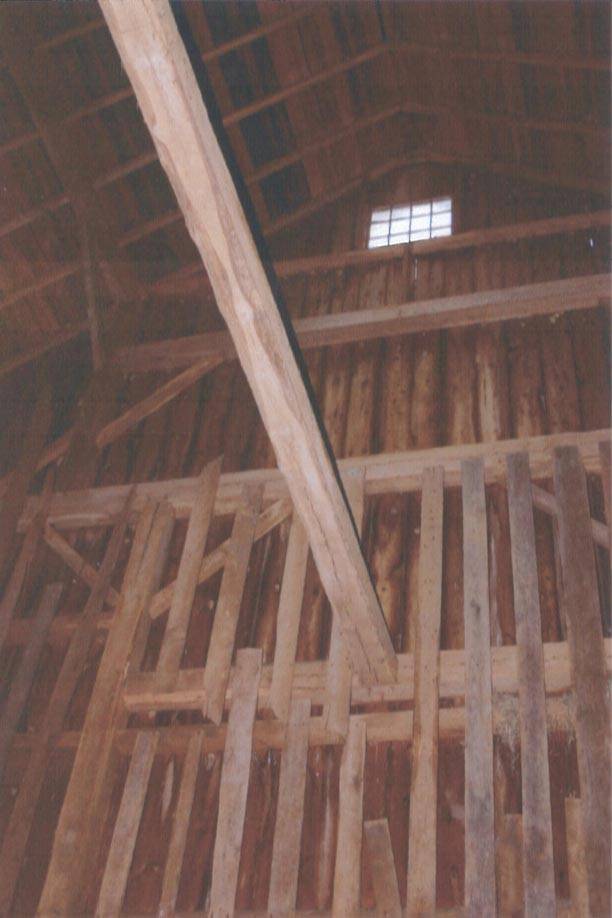
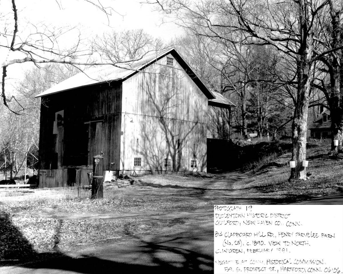
This is a 2 1/2-story side-entry, three-tiered bank barn with a cross-gable addition, resulting in a T-shaped structure. While the main entry faces northeast, the ridge-line of the main portion of the structure is perpendicular to this portion of Clapboard Hill Road, which runs southwest-northeast. The ridge-line of the cross-gable addition, which contains the main entry, is parallel to Clapboard Hill Road. The main entry is a pair of double-height, swinging hinged doors with wrought iron hardware in the center of the northeast gable-end of the cross-gable addition. This level is the top tier. The entry leads to a interior platform that continues to the southwest eave-side of the main barn. Above the main entry is a twelve-pane window in the gable attic of the northeast gable-end of the addition. The grade declines sharply at the north and east corner of the northeast gable-end of the addition revealing a tall middle tier. Both eave sides of the addition have a six-pane window on the top tier towards the intersection of the main barn and the addition. The northwest middle tier of the addition reveals a un-mortared field-stone foundation. The southeast middle tier of the foundation is open and supported by un-mortared foundation and wood posts.
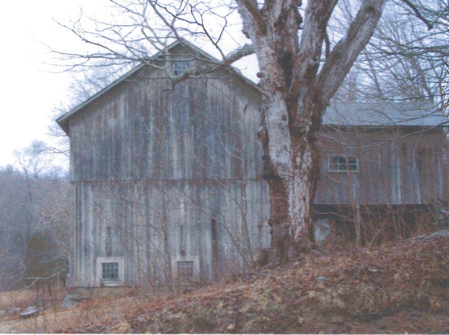
The northeast eave-side of the main barn has the addition centered on the top tier; the rest of the side is blank except for a single twelve-pane window near the north corner in the middle tier. The southeast gable-side of the main barn has three twelve-pane hopper windows along the middle tier. Above each window is a top-hinged board, about three feet long and a single board wide. In the gable attic is a twelve-pane window with trim. The grade declines sharply at the south corner of the southeast gable-side of the barn, revealing the basement tier. A stone retaining wall extends roughly south. The northwest gable-side of the barn has three twelve-pane hopper windows along the middle tier. Above each window is a top-hinged board, about three feet long and a single board wide. In the gable attic is a twelve-pane window with trim. The grade declines sharply at the north corner of the northwest gable-side of the barn, revealing the basement tier. A stone retaining wall extends to the northwest.
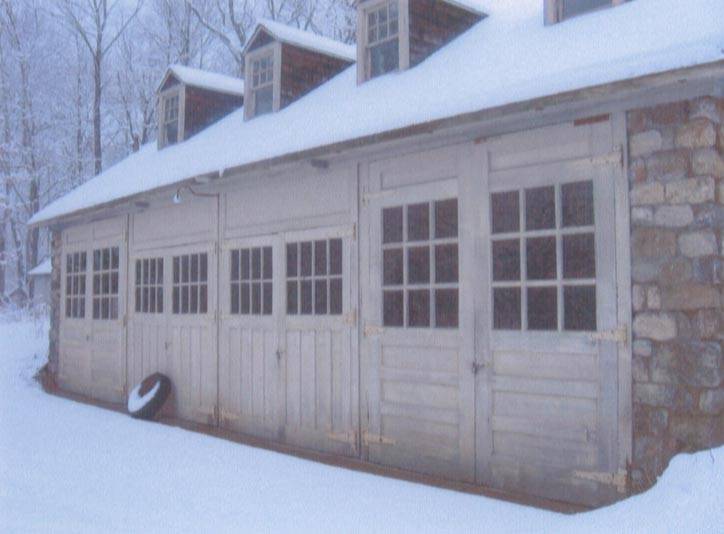
The basement tier of the southwest gable-facade of the barn has a pass-through door with wrought iron hardware at each corner. To the south of the west corner is a set of two nine-pane windows. To the west of the south corner is a set of two twelve-pane replacement windows. Centered in the facade is a pair of bi-folding doors, with wrought iron hardware. Each leaf appears to have once held three panes of glass. The middle tier of the southwest gable-facade of the barn has sliding hay door in the center, with the tracks extending to the south. Centered in the the upper tier of the southwest eave-facade are two wrought iron hinges that do not appear to be connected to a door. The rest of the facade is blank.
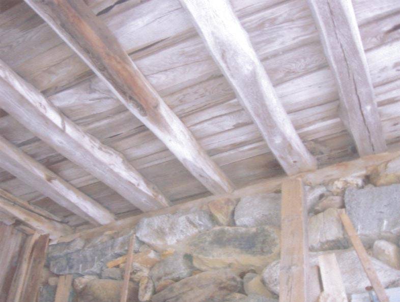
The barn has unpainted vertical tongue-and-groove siding. The roof has a projecting overhang and is covered with asphalt shingles. The foundation is un-mortared field-stone.
Historical significance:Three-tiered barns are rare in New England and particularly in Connecticut. Similar to a high-drive bank barn, the difference is a third level, often at the opposite gable end of the high drive gable entrance.
The main innovation of this three- or four-story multi-level design was to provide access near the top of the haymow so that loads could be dumped from wagons rather than hoisted into a loft above. The top main door on High-drives usually extends above the level of the eaves on the sides and often had ramps.
The oldest barns still found in the state are called the “English Barn,” “side-entry barn,” “eave entry,” or a 30 x 40. They are simple buildings with rectangular plan, pitched gable roof, and a door or doors located on one or both of the eave sides of the building based on the grain warehouses of the English colonists’ homeland. The name “30 by 40” originates from its size (in feet), which was large enough for 1 family and could service about 100 acres. The multi-purpose use of the English barn is reflected by the building’s construction in three distinct bays - one for each use. The middle bay was used for threshing, which is separating the seed from the stalk in wheat and oat by beating the stalks with a flail. The flanking bays would be for animals and hay storage.
The 19th century saw the introduction of a basement under the barn to allow for the easy collection and storage of a winter’s worth of manure from the animals sheltered within the building. The bank barn is characterized by the location of its main floor above grade, either through building into a hillside or by raising the building on a foundation. This innovation, aided by the introduction of windows for light and ventilation, would eventually be joined by the introduction of space to shelter more animals under the main floor of the barn.
Field Notes
2010 Barns Grant recipient. A contributing resource to the National Register of Historic Places Dudleytown Historic District.
- Use & Accessibility
Use (Historic)
Use (Present)
Exterior Visible from Public Road?
Yes
Demolished
n/a
Location Integrity
Original Site
- Environment
Related features
Environment features
Relationship to surroundings
The barn is the heart of a former farming complex, no longer in use. The house associated with the barn is across the road at 819 Clapboard Hill Road. The 10.83 acre site is bordered to the south by Clapboard Hill Road and to the east by Podunk Road. West of the barn is a corral with a milk house and corn crib. To the southwest of the milk house is a shed. A stone wall extends north from the southwest corner of the site. A stream cuts across the site, winding by a small cabin towards the middle of the site. East of the barn is a garage with an apartment. East of the garage is a stone wall that fronts Clapboard Hill Road, turning north along Podunk Road. The entire site is mostly woodland now. The area surrounding the site is residential and woodland.
- Typology & Materials
-
Building Typology
Materials
Structural System
Roof materials
Roof type
Approximate Dimensions
65'6" x 45'9" overall
- Source
-
Date Compiled
11/10/2010
Compiled By
Todd Levine, reviewed by the Connecticut Trust
Sources
Photographs by Nona Bloomer & Cindy ingraham.
Map of Guilford, CT, retrieved on November 10, 2010 from website www.zillow.com.
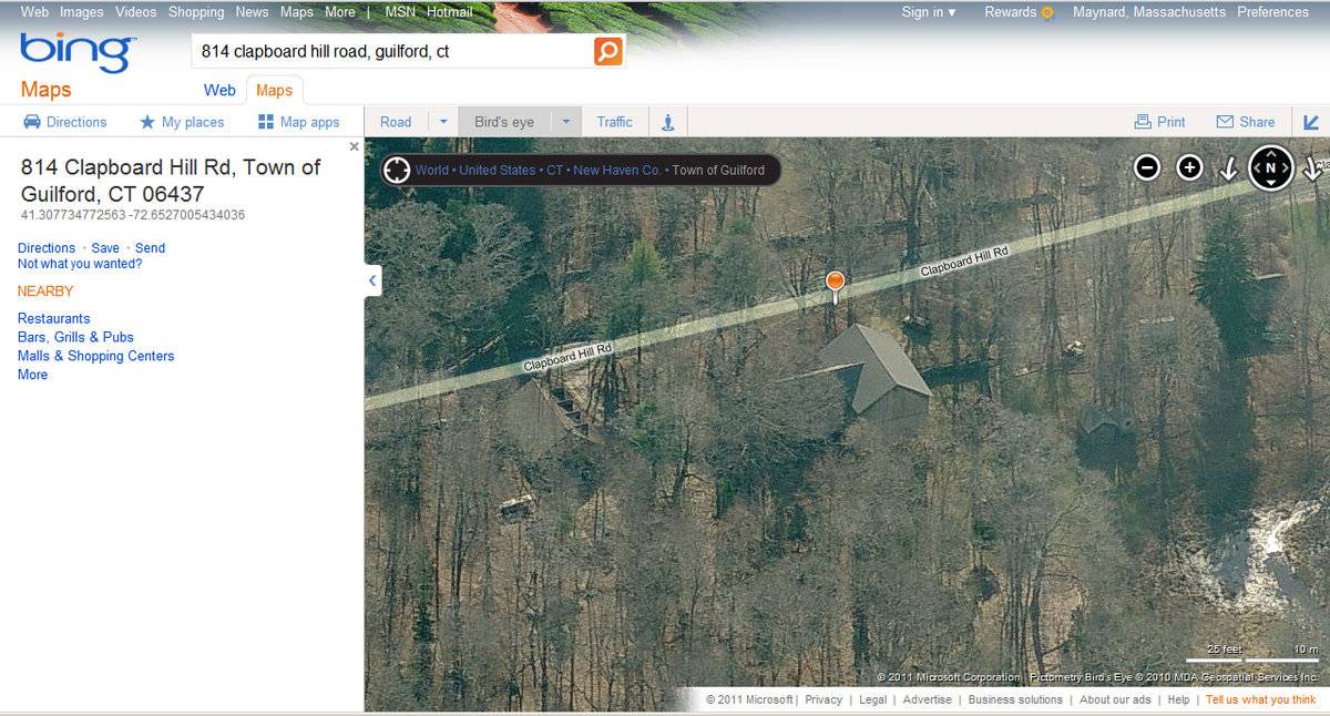
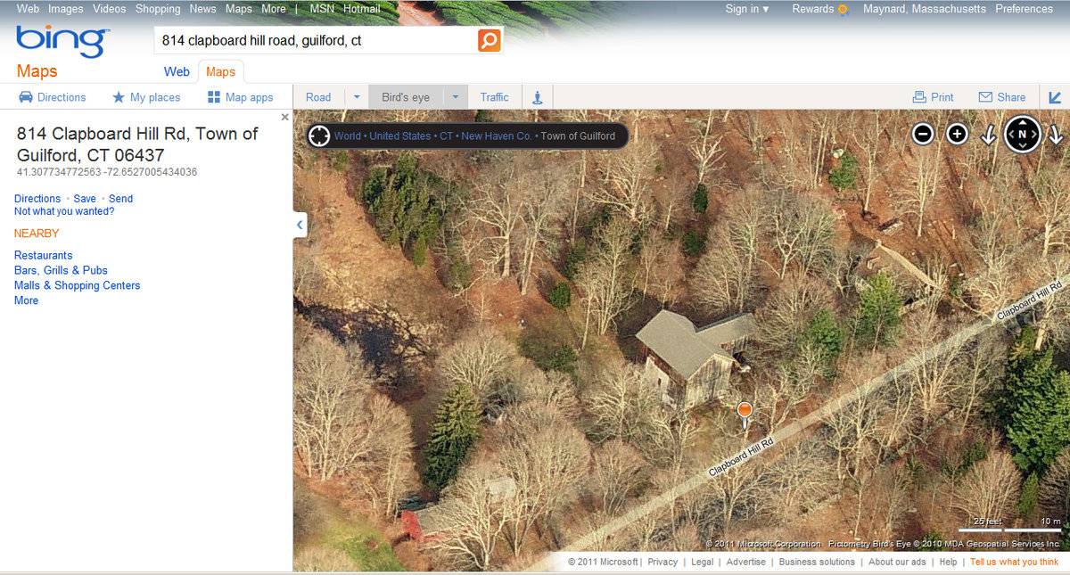
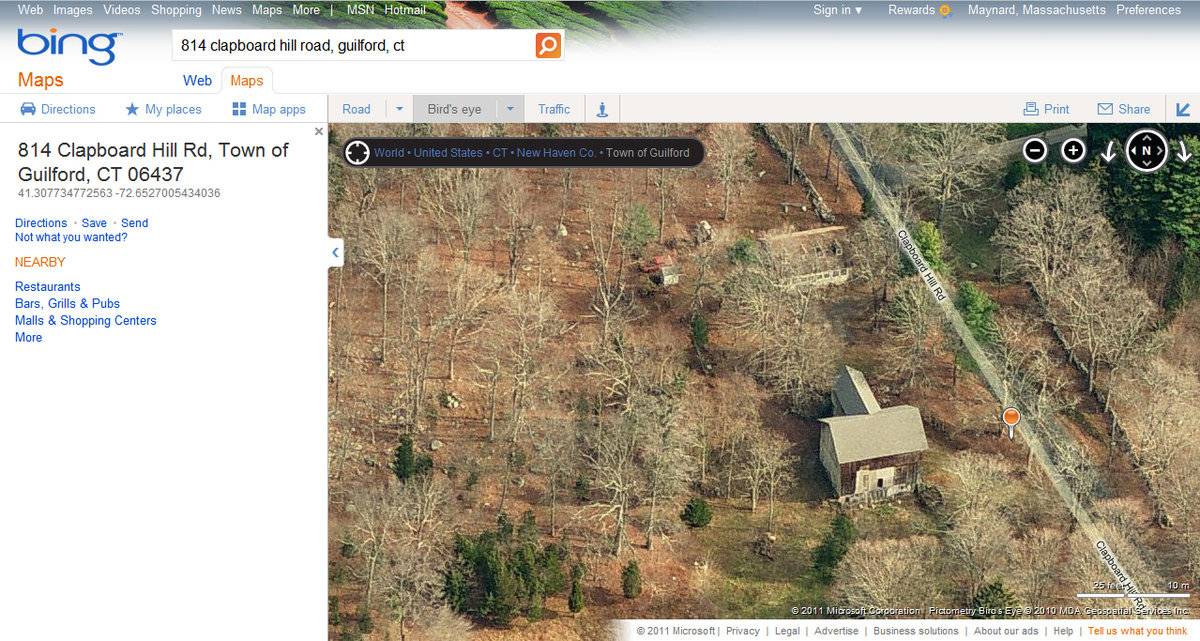
Aerial Mapping: Guilford Maps
http://www.bing.com/maps - accessed 9/22/2011.eQuality Valuation Services, LLC Database. http://www.equalitycama.com/tvweb/MainSearch.aspx?city=guilford.
Sexton, James, PhD; Survey Narrative of the Connecticut Barn, Connecticut Trust for Historic Preservation, Hamden, CT, 2005, http://www.connecticutbarns.org/history.
Visser, Thomas D.,Field Guide to New England Barns and Farm Buildings, University Press of New England, 1997.
Brown, Elizabeth & Wigren, Christopher, National Register of Historic Places Nomination #416520, Dudleytown Historic District, 1991. Item No. 91000951 NRIS (National Register Information System) http://pdfhost.focus.nps.gov/docs/NRHP/Text/91000951.pdf http://pdfhost.focus.nps.gov/docs/NRHP/Photos/91000951.pdf
- PhotosClick on image to view full file
-