Barn Record Bloomfield
RETURN TO ‘FIND BARNS’- Building Name (Common)
- 4-H Education Center at Auer Farm - Part 2 of 2
- Building Name (Historic)
- Auer Farm Apple Barn
- Address
- 4 Auer Farm Road, Bloomfield
- Typology

- Overview
-
Designations
Historic Significance
Architectural description
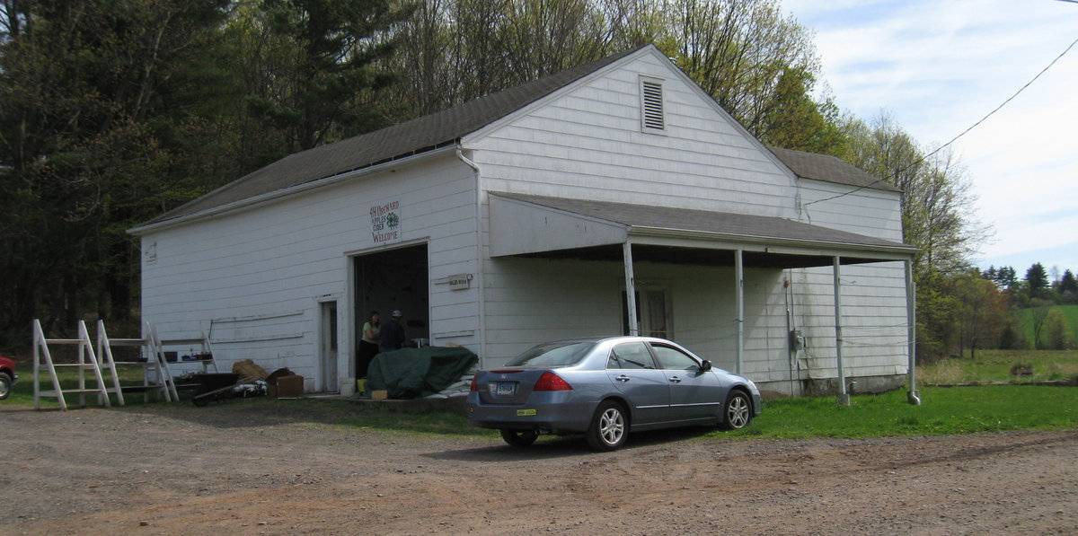
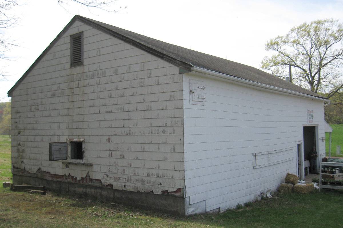
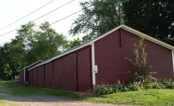
This is a 1 1/2-story eave-entry barn with a gable roof and a gable-roof addition. The main ridge-line runs east-west. The barn is on a hill top, slightly above grade that declines from north to south, exposing a concrete foundation. The main north eave-facade grade level has an earth and concrete ramp that rises up to the main entry at the barn’s northwest corner, which is a double-height overhead garage door. Across the middle of the garage door are two sets of three evenly and closely spaced windows. Immediately east of the garage door, is a side-swinging pass-through half-glass door.
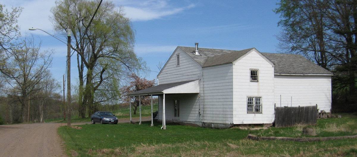
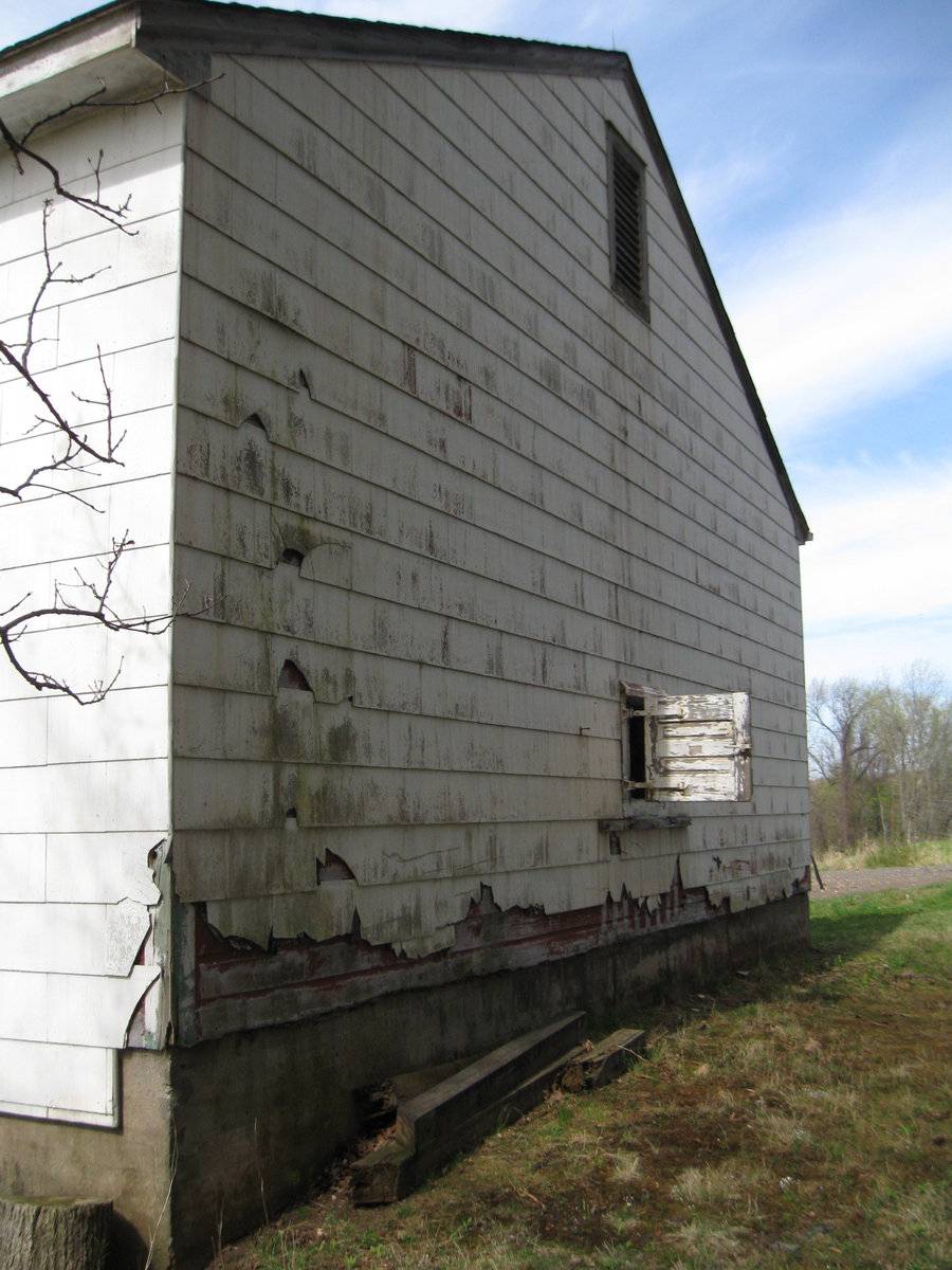
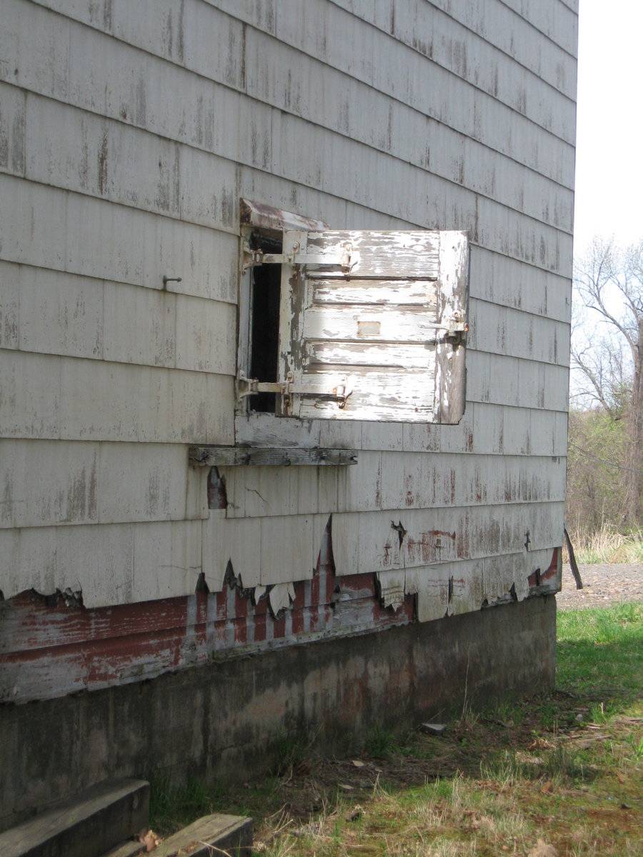
Just beneath the eave of the main north eave-façade is a square, side-swinging door with wrought iron hardware next to the barn’s northeast corner. The west gable-end of the barn has a pair of centered side-swinging single-pane French doors. Covering the doors and encompassing the west gable-end is a 1-story pent-roof porch supported by four evenly spaced pipe columns, set on four cylindrical concrete supports. The west gable attic has a centered rectangular outlet ventilator. The south eave-side of the barn has a 2-story gable-roof addition on the southwest corner. The 2-story gable-roof addition’s west eave-side is flush with the barn’s west gable-end. The 2-story gable-roof addition ridge-line is perpendicular to the barn’s ridge-line. The addition’s south gable-end has a pair of centered six-over-six double-hung windows with trim and thick muntins on the first story. The addition’s south gable-end has a centered eight-over-eight double-hung window with trim on the second story. The barn’s south eave-side has a first-story window just east of the 2-story addition’s northeast corner. The barn’s east gable-end first floor has a centered square side-swinging door. The barn’s east gable attic has a centered rectangular outlet ventilator.
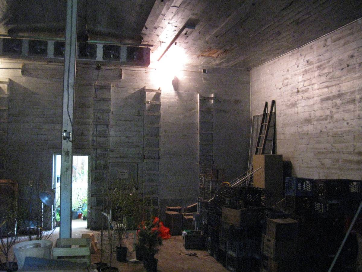
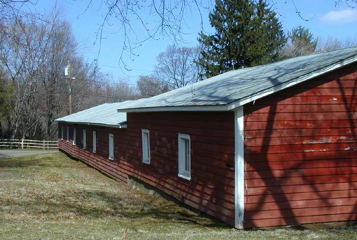
The barn has a wide plank floor and built-up walls. The interior walls are flush-board siding, while the exterior walls are red clapboard siding covered almost completely by white asbestos siding. The roof is covered with asphalt shingles.
Historical significance:The oldest barns still found in the state are called the “English Barn,” “side-entry barn,” “eave entry,” or a 30 x 40. They are simple buildings with rectangular plan, pitched gable roof, and a door or doors located on one or both of the eave sides of the building based on the grain warehouses of the English colonists’ homeland. The New England barn or gable front barn was the successor to the English barn and relies on a gable entry rather than an entry under the eaves. The gable front offers many practical advantages. Roofs drain off the side, rather than flooding the dooryard. Although it was seen by many as an improvement over the earlier side entry English Barn, the New England barn did not replace its predecessor but rather coexisted with it. In this case the two styles are combined; both a gable entry and an eave entry are used.
With new developments in storage methods, fruit production was no longer seasonal. The first technological improvement was the use of controlled temperature and humidity to store fruit after the harvest. For example, a warehouse for this purpose was built in 1926 at Rogers Orchards in Southington. A more modern storage plant, utilizing an oxygen reduction atmosphere to retard ripening, was constructed [at Rogers Orchards] in 1984. Following the harvest, the building is sealed and the oxygen content is reduced to three percent.
Historical background:Today’s 120-acre 4-H Education Center at Auer Farm, located in the northwest section of Bloomfield, Connecticut was deeded to the non-profit Connecticut 4-H Development Fund, Inc. in 1976. The farm, as the 4-H Education Center, is committed to growing its successful educational programs and community outreach efforts on this historic community resource.
The farm, founded in the early years of the 20th century, was honored as a model farm in 1950 and was the site for the annual Connecticut Farm Conference in the late 1940s and 1950s. The driving force for the long-term success of the farm was Beatrice Fox Auerbach. When her husband died in apples on more than 300 trees. Both the dairy barns and poultry houses used the latest technology. Milk was processed on the farm. Milk, eggs and other farm products were sold at the G. Fox Department Store. Nine homes on the property housed farm families and a dormitory housed seasonal employees.
Dignitaries from throughout the country, including Eleanor Roosevelt, visited the farm and were impressed by the quality of the crops and animal production. Farmers from abroad came to learn modern practices for use in their countries. Besides running the farm, Mrs. Auerbach achieved national prominence in the 1930s as the first female president of a leading department store, G. Fox & Co. Her good business sense, humanitarian work practices and philanthropic ventures left a legacy from which people benefit today. Mrs. Auerbach also supported 4-H by sponsoring the statewide 4-H dress revue held at the department store.
Field Notes
Farm History: http://www.auerfarm.org/about_auer_farm_education_center_history.php Buildings include a clay tile mushroom barn (see Part 1) visible from Route 185 north of the entrance, an apple storage barn at the top of the hill, and dairy facilities now converted to 4-H education center down the far side of the hill at the western part of the farm. Tax Assessor has this property listed as 147 Auer Farm Road.
- Use & Accessibility
Use (Historic)
Use (Present)
Exterior Visible from Public Road?
Yes
Demolished
n/a
Location Integrity
Unknown
- Environment
Related features
Environment features
Relationship to surroundings
The apple barn is at the top of a hill and to the east of the house it is associated with. The main house ridge line is parallel to the ridge line of the barn. Set on the hill side, the main house is on the southwest quadrant of the property and faces north toward Auer Farm Road. Adjacent to the north and east of the house is a foundation garden. A residential lawn is east, north, and west of the house. South of the house lawn is a garage. The ridge-line of the garage is parallel to the house ridge line. West of the garage is a driveway that proceeds west to Auer Farm Road. From the garage, the driveway connects into a road network that provides access to the dairy facilities converted to the 4-H Education Center. Auer Farm Road proceeds west of the house and attaches the road network to the west. Just south of Auer Farm Road and west of the house is barn II, its ridge-line perpendicular to the ridge-line of the house. South and east of barn II is an open green lawn that has sheds I and II aligned along the lawn’s south and west border, respectively. At the southwest corner of the open green lawn is shed III.
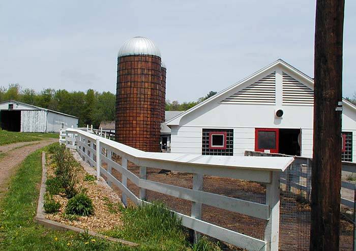
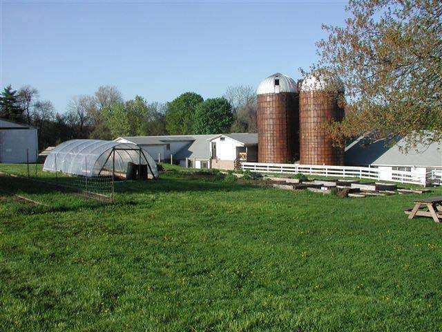
West of sheds I-III and southwest of the main house are residences II-VII, laid out it a rough rectangular pattern. Four of residences II-VII roof ridge-lines are parallel to the main house, while the other two roof ridge-lines are perpendicular to the ridge of the main house. North of the residences II-VII and west of the main house is a set of seven buildings and picnic shelter arranged in a rough grid pattern and mostly associated with diary production. The core of this grid has four buildings aligned in two rows on a north-south axis in the southeast quadrant of the grid, set on top of an asphalt parking pad. The first axis of the core has three buildings. The most southeastern building in the first axis is a one story office, followed to the north by garage II. North of garage II is a dairy. West of the first core axis, the second axis consists of a cow barn, barn II. A covered passageway connects barn II to garage II. The southwest corner of barn II has a fenced-in barnyard and two silo tanks. The ridge lines of the core buildings (office, garage II, dairy, and barn III) are perpendicular to the house. North of the core buildings and in the northeast corner of the grid is a picnic shelter. Its gable ridge is parallel to the gable ridges of the core buildings and perpendicular to the house. East of the picnic shelter is a white picket fence that runs south to the northeast corner of garage II. The white picket fence is the east border of an open lawn that surrounds the picnic shelter, and extends west to barn IV, which is on the northeast corner of the grid. Its ridge line runs perpendicular to the core buildings and parallel to the house. Barn IV has a fenced-in and segmented barnyard to its south. The open lawn extends south past the west side of the core.The open lawn has two additional buildings. South of barn IV and west of the northwest corner of barn III is shed IV. Southeast of shed IV, a footpath starts on the west side of barn III and proceeds west to barn V, its ridge-line parallel to the core buildings and perpendicular to the house. West of the set of seven buildings and picnic shelter is open pasture, outlined by woodland. Southwest of the buildings is a rectangular lawn, which contains a mixture of small, fenced-in gardens and animal pens.
Auer Farm Road is the only landscape feature that directly ties the apple barn to the farm complex. Auer Farm Road starts at the southeast corner of the set of eight buildings and proceeds east past the north gable end of barn II and curves in an arc east and north of the main house. Then, Auer Farm Road proceeds northeast up the hill in a meandering curvilinear fashion past woodland and pastures to north of the apple barn on the hill top. Auer Farm Hill Road is the west border of a lawn that surrounds The apple barn. The north border of the lawn is Cider Hill Road. Between the apple barn’s south eave-side and the 2 story addition east-eave side is a partly fenced-in yard. Just inside the lawn’s south border is an elliptical garden outlined with cut-stone. An agricultural field outlines the lawn’s south border, including the semielliptical cut for the cut-stone lined garden. Woodland defines the barn lawn’s west border. Northeast and north of Auer Hill Road is open land. Cider Hill Road is lined by trees. East of tree lines of Cider Hill Road is a set of agricultural fields.
Cider Hill Road starts from Auer Farm Road and proceeds south until it dead ends in residences VIII-IX to the southwest and shed V to the northeast. Woodland surrounds residences VIII-IX, and shed V is on the west edge of an orchard. Auer Farm Hill Road proceeds down the hill in a curving northeast direction to a tilled field on its north border, which contains barn VI (mushroom barn described in part 1) to end at Simsbury Road. Barn VI is in the north half of the tilled field. Simsbury Road is the east border of the tilled field and property. The T intersection between Auer Farm Road and Simsbury Road is the northeast corner of the field with signage pointing the way to the farm complex. The size of Auer Farm is 120 acres. The area around the property is rural, residential, open land, and woodland.
Map/Lot/Unit: 85-4/ / 1168/ /
- Typology & Materials
-
Building Typology
Materials
Structural System
Roof materials
Roof type
Approximate Dimensions
n/a
- Source
-
Date Compiled
03/19/2011
Compiled By
J. Toner & T. Levine, reviewed by CT Trust
Sources
Aerial Mapping:
http://www.bing.com/maps accessed 3/19/2011.Field notes and photographs by Charlotte Hitchcock and from Auer Farm website
< http://www.auerfarm.org >on 4/17/2010.
http://www.auerfarm.org/about_auer_farm_education_center_history.php
McAlester, Virginia and Lee. A Field Guide to American Houses, Alfred A. Knopf, 1984.National Register Nomination, National Park Service, 2007 (per SHPO files).
Phillips, Steven J. Old House Dictionary, an Illustrated Guide to American Domestic Architecture, 1600-1940, The Preservation Press, National Trust for Historic Preservation, 1994.
Sexton, James, PhD, Survey Narrative of the Connecticut Barn, Connecticut Trust for Historic Preservation, Hamden, CT, 2005, http://www.connecticutbarns.org/history.
Town of Bloomfield Assessor’s Record and GIS Viewer: http://www.visionappraisor.com
Map/Lot/Unit: 85-4/ / 1168/ /
Visser, Thomas D., Field Guide to New England Barns and Farm Buildings, University Press of New England, 1997. - PhotosClick on image to view full file
-