Barn Record Bolton
RETURN TO ‘FIND BARNS’
- Overview
-
Designations
n/a
Historic Significance
Architectural description:
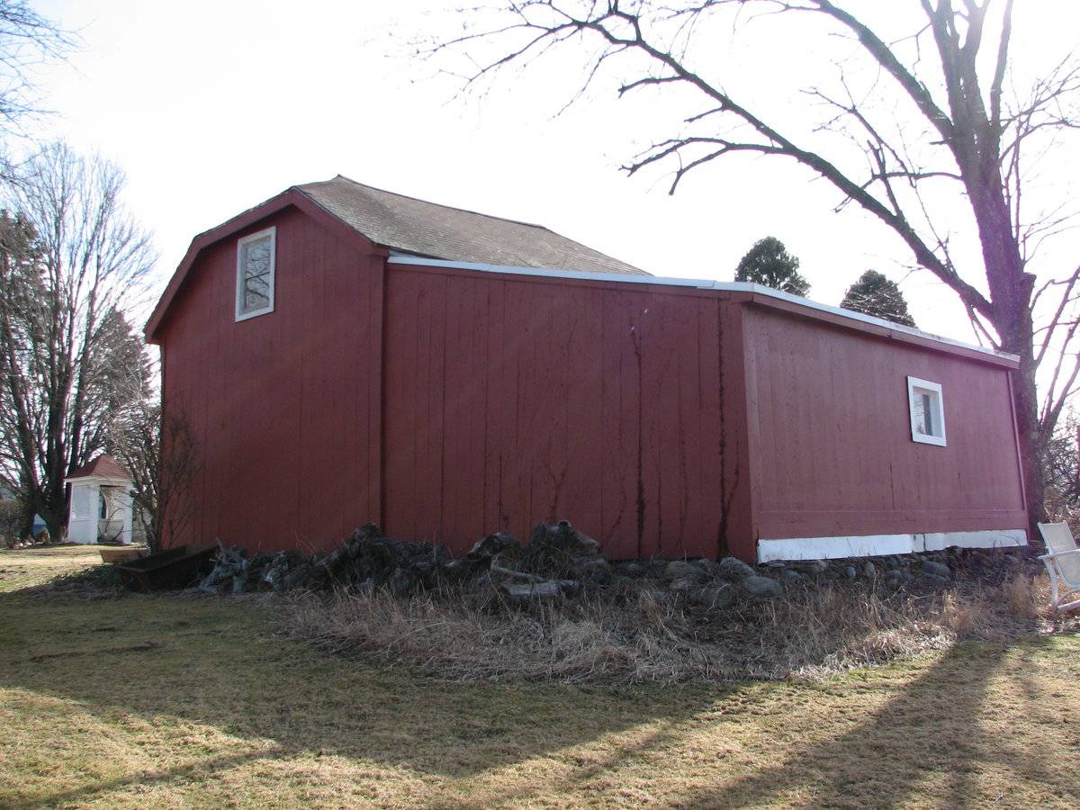
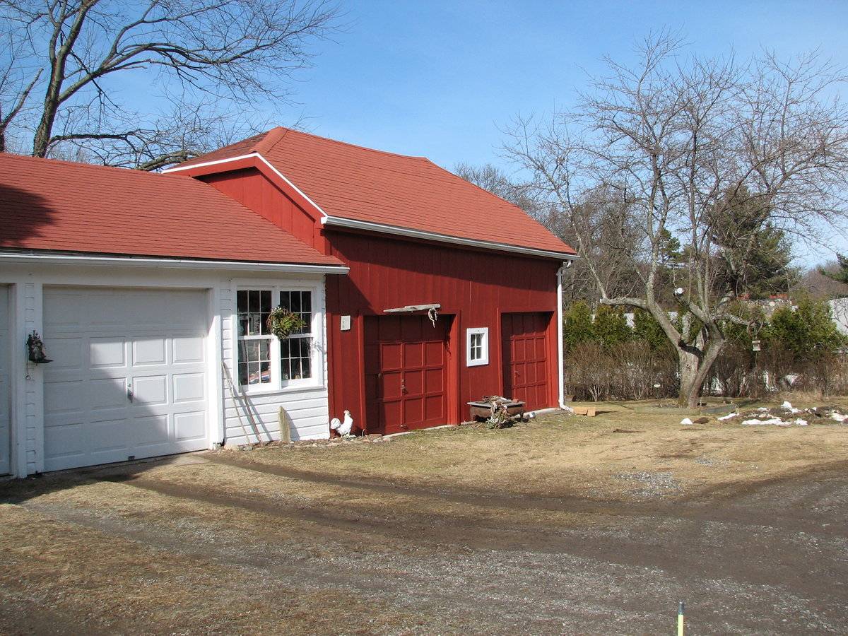
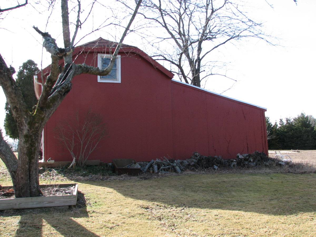
This is a 1 1/2-story, hip-roofed eave-entry barn with a shed-roofed addition and a gable-roofed addition. The main facade faces south and the ridge-line of the barn is parallel to this portion of Birch Mountain Road, which runs approximately east-west. The main entries in the south eave-facade of the barn are two overhead garage doors. Centered in between the two is a four-pane window with trim. The east gable-side of the barn has a one-over-one double-hung window in the gable attic; the rest of the facade is blank. Extending north from the north eave-side of the barn is a shed-roofed addition. The addition encompasses the entire width of the barn and the sides of the addition are flush with the gable-sides of the barn. Centered in the addition’s north side is a single window with trim. extending west from the west gable-side of the barn is a gable-roofed addition, painted white. The south eave-facade of the gable-roofed addition has two six-over-six double-hung windows and two overhead garage doors. The barn has vertical flush-board siding and corner boards painted red with white trim. The foundation of the addition is field-stone. The roof is hipped and has asphalt shingles.
Historical significance:The oldest barns still found in the state are called the “English Barn,” “side-entry barn,” “eave entry,” or a 30 x 40. They are simple buildings with rectangular plan, pitched gable roof, and a door or doors located on one or both of the eave sides of the building based on the grain warehouses of the English colonists’ homeland. The name “30 by 40” originates from its size (in feet), which was large enough for 1 family and could service about 100 acres. The multi-purpose use of the English barn is reflected by the building’s construction in three distinct bays - one for each use. The middle bay was used for threshing, which is separating the seed from the stalk in wheat and oat by beating the stalks with a flail. The flanking bays would be for animals and hay storage.
Field Notes
Broda Apple Orchard Farm (original house burned down in 1858). Dairy barn built approximately 1900. The family lost all of their apple trees in the 1938 Hurricane, and the barn was rebuilt and modified with an attached garage.
- Use & Accessibility
Use (Historic)
Use (Present)
Exterior Visible from Public Road?
Yes
Demolished
n/a
Location Integrity
Unknown
- Environment
Related features
Environment features
Relationship to surroundings
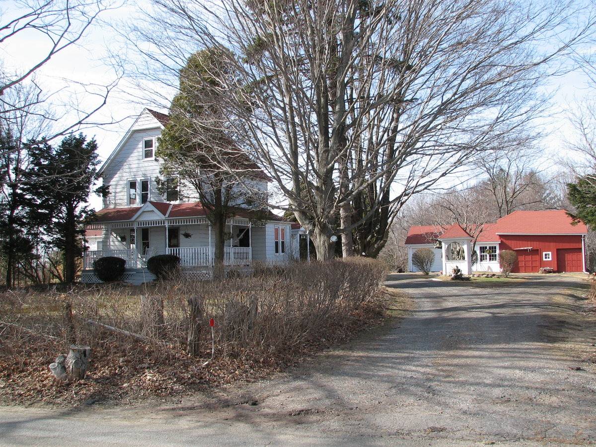
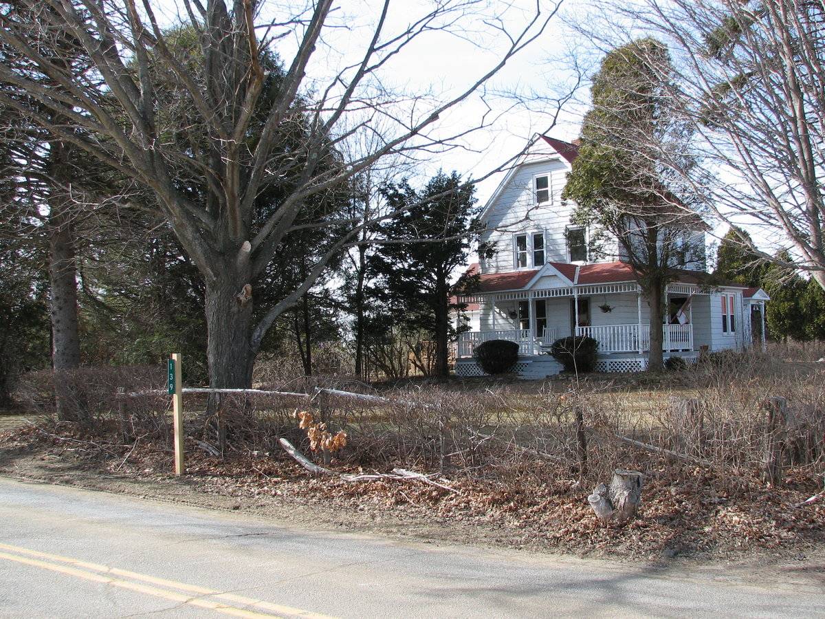
The barn is behind and to the northeast of the c.1890 house it is associated with. The ridge-line of the house is perpendicular to the ridge-line of the barn. A driveway runs from Birch Mountain Road to the south, by the house on the east, to the gable-roofed addition of the barn. A yard is to the east of the house. To the north of the barn is a track of open space. The total size of the site is 4.20 acres. Further north is woodland. To the west of the house is a line of trees, then a track of open space. The area surrounding the site is residential, open space and woodland.
Map/Block/Lot 00004 00031 00011- Typology & Materials
-
Building Typology
Materials
Structural System
n/a
Roof materials
Roof type
Approximate Dimensions
n/a
- Source
-
Date Compiled
10/01/2010
Compiled By
Todd Levine, reviewed by the Connecticut Trust
Sources
Photographs and field notes by Kim and Dave Malley.
The Capitol Region Council of Governments website. http://www.crcog.org/gissearch/
Map of Bolton, CT, retrieved on October 1, 2010 from website www.zillow.com.
eQuality Valuation Services, LLC Database. http://www.equalitycama.com/tvweb/MainSearch.aspx?city=Bolton
Sexton, James, PhD; Survey Narrative of the Connecticut Barn, Connecticut Trust for Historic Preservation, Hamden, CT, 2005, http://www.connecticutbarns.org/history.
Visser, Thomas D.,Field Guide to New England Barns and Farm Buildings, University Press of New England, 1997.
- PhotosClick on image to view full file
-