Barn Record Ashford
RETURN TO ‘FIND BARNS’- Building Name (Common)
- n/a
- Building Name (Historic)
- n/a
- Address
- 130 Mansfield Road (Route 89), Ashford
- Typology

- Overview
-
Designations
n/a
Historic Significance
Architectural description: The property has two barns.
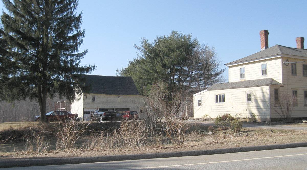
Barn A is a 2 ½-story gable-roofed structure with its ridge line running north-south, located behind and to the south of the house. Its eave-side doors in the east façade at the grade level of the road have been expanded to three garage door openings. There are two double hung windows in the upper level. An attached shed extends off the north wall. There appears to be a lower level at the west rear. Siding is a combination of vertical board and wood shingle siding. The roof is asphalt shingles; there is some visible deformation in the east wall.
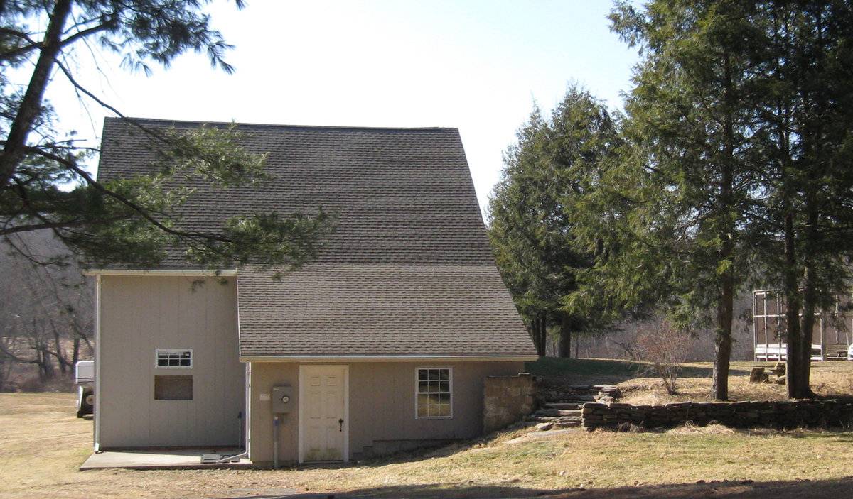
Barn B appears to be a new gable-roofed horse barn, with its ridge line oriented north-south, an upper level facing north toward the house and a lower level with sliding barn doors in the gable-end opening toward the south to pastures and a hay door flanked by double hung windows above. A shed-roofed addition is on the east side at the northeast corner.
Historical significance:The oldest barns still found in the state are called the “English Barn,” “side-entry barn,” “eave entry,” or a 30 x 40. They are simple buildings with rectangular plan, pitched gable roof, and a door or doors located on one or both of the eave sides of the building based on the grain warehouses of the English colonists’ homeland. The name “30 by 40” originates from its size (in feet), which was large enough for 1 family and could service about 100 acres. The multi-purpose use of the English barn is reflected by the building’s construction in three distinct bays - one for each use. The middle bay was used for threshing, which is separating the seed from the stalk in wheat and oat by beating the stalks with a flail. The flanking bays would be for animals and hay storage.
The 19th century saw the introduction of a basement under the barn to allow for the easy collection and storage of a winter’s worth of manure from the animals sheltered within the building.
The bank barn is characterized by the location of its main floor above grade, either through building into a hillside or by raising the building on a foundation. This innovation, aided by the introduction of windows for light and ventilation, would eventually be joined by the introduction of space to shelter more animals under the main floor of the barn.
Historical background:The town of Ashford was incorporated in 1714 and for its first century had the typical scattered settlement on upland ridges which characterized nearly all of Connecticut. The economy was community-subsistence agriculture. Industry was limited to the mills of the agricultural economy – grist, saw, fulling mills.
In the early 19th century, turnpikes and improved roads, along with limited market-oriented agriculture, resulted in some local wealth and settlement nuclei at the major crossroads. Ashford Center, Westford, and Warrenville date from this period. So do the fancy Federal-style houses in these villages and along Route 89 (Mansfield Road) south of Warrenville. Also in this period there existed a short-lived glass factory at Westford.
In the 19th century, the lack of significant waterpower and railroad connections led to stagnation. Its peak population, 1820 (2,778) which had declined to 668 by 1910, was not exceeded until 1980.
In the early 20th century, the declining farms of Ashford were abandoned by their Yankee owners and sold to East European immigrants, notably Slovaks, Bohemians, and Hungarians (Magyars). This transformation of the rural countryside is one of the great stories of modern Connecticut. Today a large portion of the town is descended from these people.
Today Ashford remains a beautiful, scenic town. All roads are mostly scenic, with wooded, overgrown pastures (stone walls, young hardwoods) predominating (Clouette, Ashford survey).Field Notes
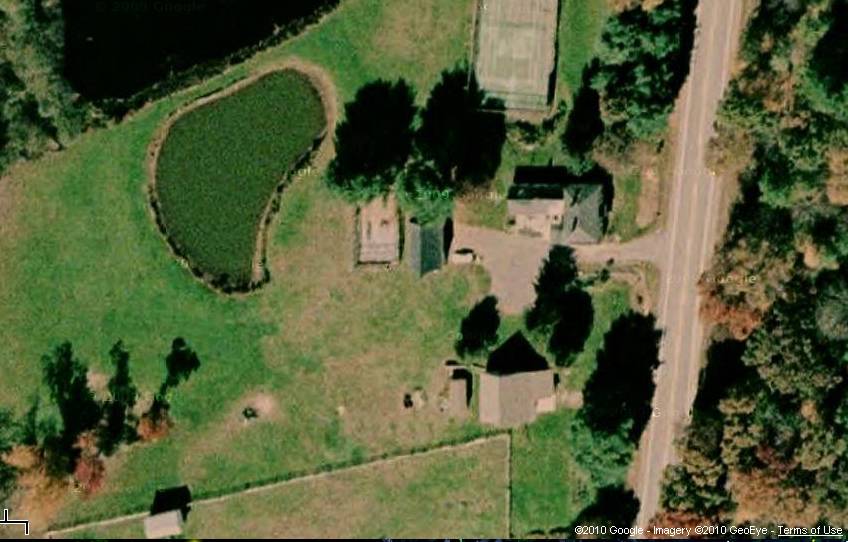
Gentleman farm with two barns, pond, tennis courts, on east bank of Mt. Hope River.
- Use & Accessibility
Use (Historic)
Use (Present)
Exterior Visible from Public Road?
Yes
Demolished
n/a
Location Integrity
Unknown
- Environment
Related features
Environment features
Relationship to surroundings
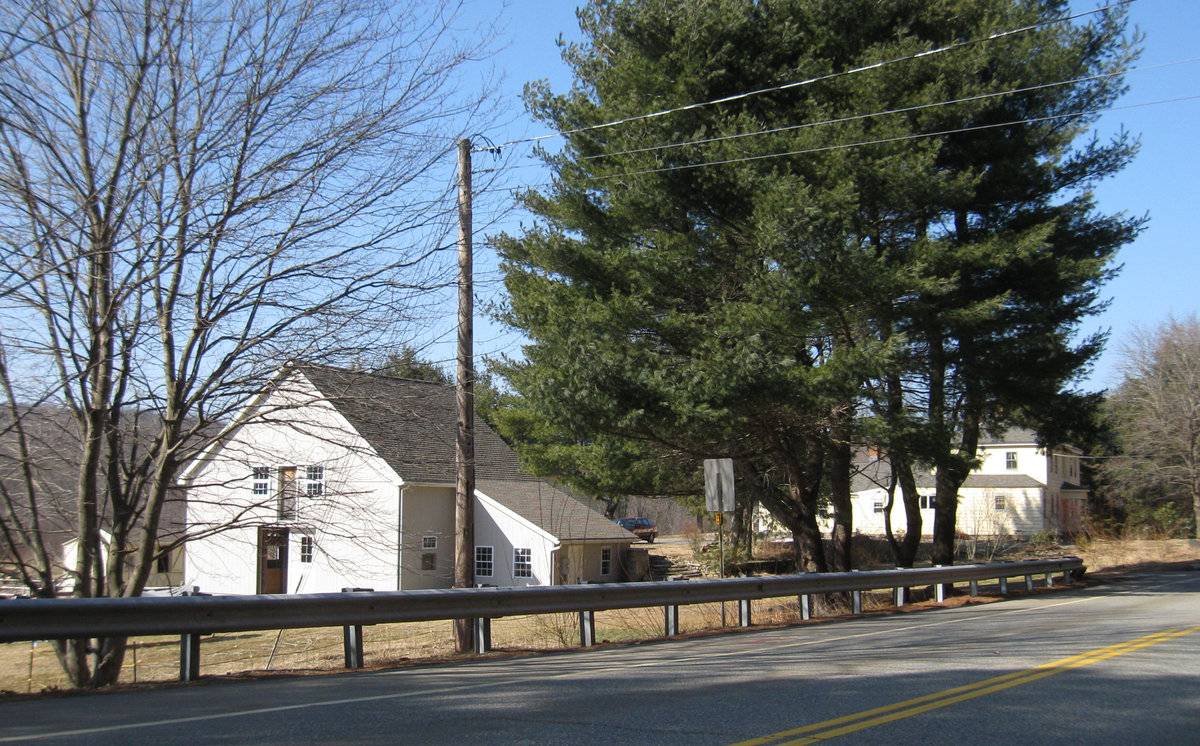
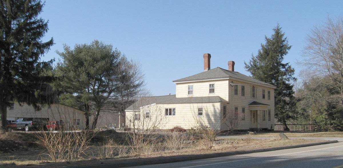
Located south of the center of Ashford (the village of Warrenville) along the east bank of the Mt. Hope River. To the north, US Route 44 (known locally as Ashford Center Road or Pompey Hollow Road)runs east-west, and has most of the commercial and municipal services for the town. Mansfield Road crosses the southern part of Ashford, leading south into Mansfield. It is an area of some open fields, much woodland and wetlands along the Mt. Hope River, and scattered 19th-century farmhouses and 20th-century suburban homes. This 8-acre parcel is on the west side of the road, and includes open fields and a pond stretching west to the river. The house is a 2-story 5-bay hip-roofed Federal style structure with a hip-roofed porch in the center of the 1st floor over the entry door and a 3-part Palladian window above at the 2nd floor level. The Assessor’s record gives a date of 1860, but the house is a near-twin of its neighbor at 274 Mansfield Road, whose date is given as 1800. The house is at the level of the road, as is the east entrance to the barn. Grade slopes down on three sides to the west, south, and north of the main barn.
- Typology & Materials
-
Building Typology
Materials
Structural System
Roof materials
Roof type
Approximate Dimensions
barn 726 square feet, Shed 276 square feet, Barn 418 square feet
- Source
-
Date Compiled
03/17/2010
Compiled By
Charlotte Hitchcock, reviewed by CT Trust
Sources
Field notes and photographs by Charlotte Hitchcock 3/10/2010
Town of Ashford Assessor’s Record Map/Lot 40/ A/ 9/
(house built 1860, 8 acres, barns 726 S.F. Shed 276 S.F. Barn w Loft 418 S.F.).Bayles, Richard M.; History of Windham County, Connecticut, New York: W.W. Preston, 1889. excerpts available at
< http://www.connecticutgenealogy.com/windham/ashford.htm >.
Clouette, Bruce, National Register of Historic Places, Church Farm, Nomination #270921, 1988. Item No. 88002650 NRIS (National Register Information System) http://pdfhost.focus.nps.gov/docs/NRHP/Text/88002650.pdf
< http://pdfhost.focus.nps.gov/docs/NRHP/Photos/88002650.pdf >Clouette, Bruce, Ashford Township Survey, handwritten manuscript, Connecticut Trust for Historic Preservation, 199x.
Sexton, James, PhD, Survey Narrative of the Connecticut Barn, Connecticut Trust for Historic Preservation, Hamden, CT, 2005, http://www.connecticutbarns.org/history.
Visser, Thomas D., Field Guide to New England Barns and Farm Buildings, University Press of New England, 1997.
- PhotosClick on image to view full file
-