Barn Record Branford
RETURN TO ‘FIND BARNS’- Building Name (Common)
- Johnson Farm
- Building Name (Historic)
- Johnson Farm
- Address
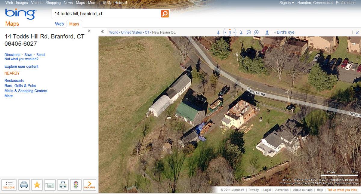
- 14 Todds Hill Road, Branford
- Typology

- Overview
-
Designations
n/a
Historic Significance
Architectural description:
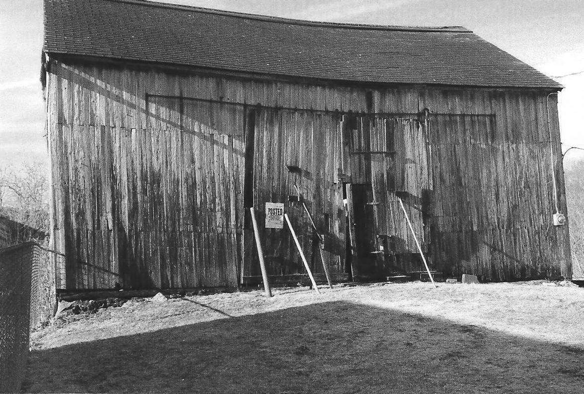
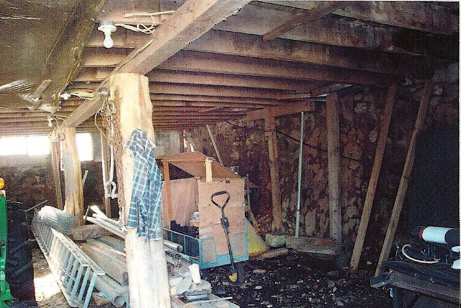
The barn is a 1 &½-story, gable-roof, rectangular structure sited against an embankment. The ridge-line is aligned east-west, with the axis of the ridge extending roughly parallel to the course of the public road.
The principal façade and “upbank” side of the barn is the north eave-side. The only opening on this wall is the main entry, which holds double-height, double-leaf, exterior sliding doors mounted on an open track. The doors are of board-and-batten construction.
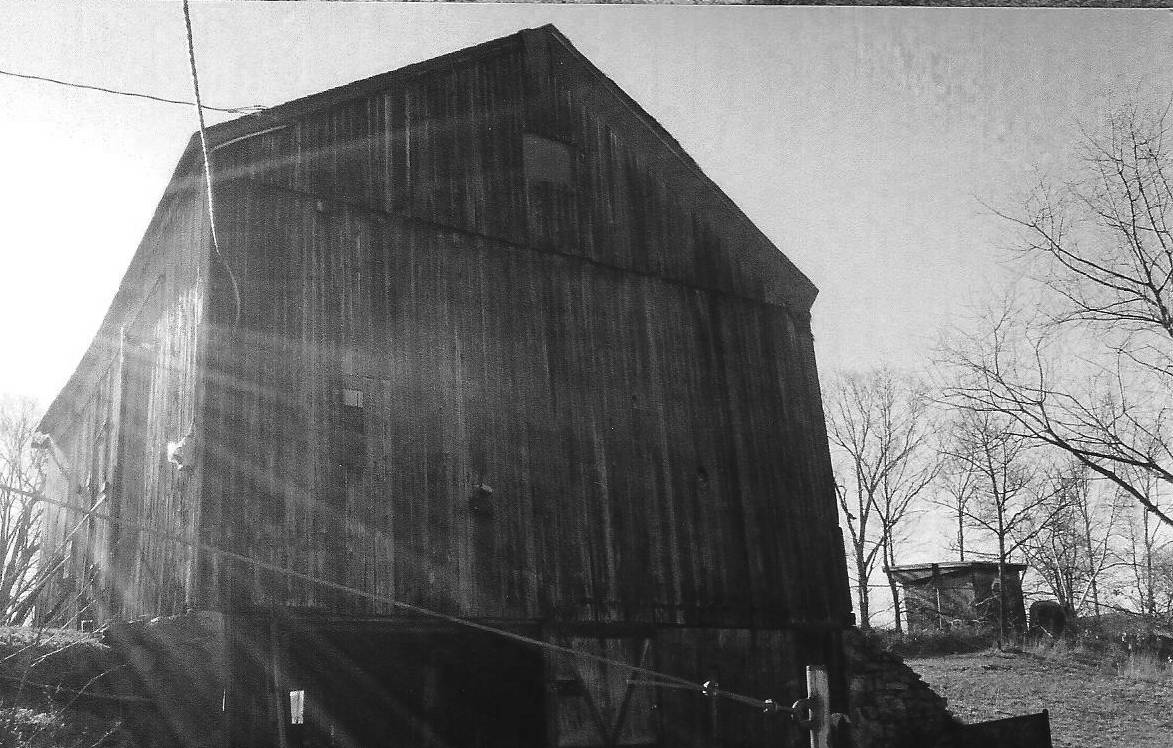
The west gable-end side of the barn has the masonry basement wall completely exposed and above grade. In the basement there is a double-leaf doorway sited at the north corner, fitted with exterior sliding doors mounted on an open track. The doors are of board-and-batten construction; the north door bears an exterior batten design of “Union Jack” form (diagonals over a cross) while the south door is plain, with interior battens. The gable attic has a fixed sash window over the center of the wall.
The foundation is of rubble fieldstone construction. The barn is clad in vertical flush-board and the roof is covered with asphalt shingle. The roof extends beyond the eaves by just a few inches.
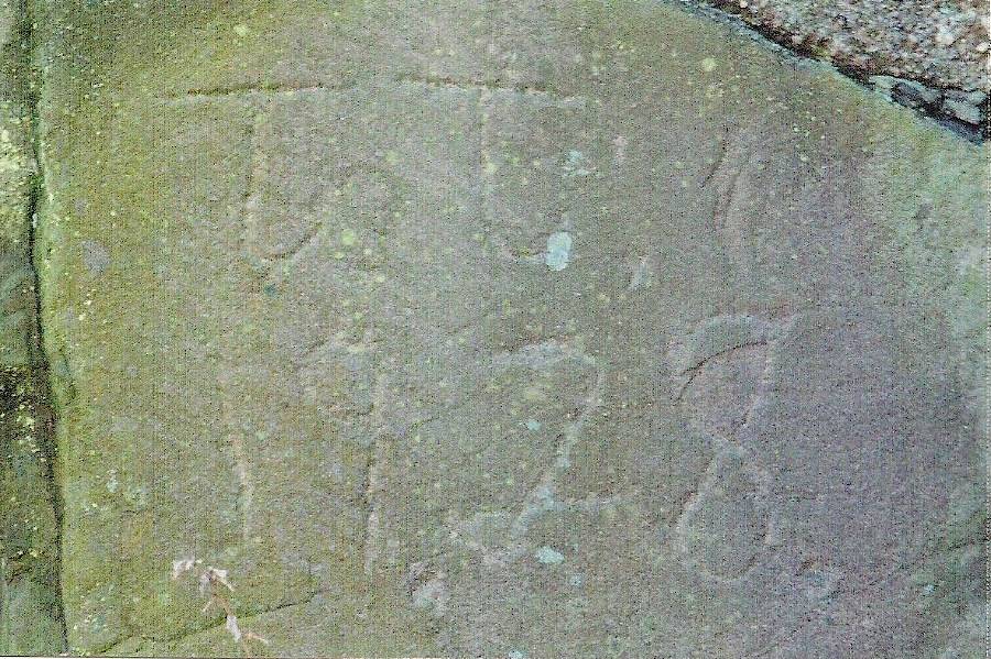
The foundation wall has an inscribed datestone embedded in the wall with the inscription, “TT 1928.” In the basement interior, the floor framing is visible, consisting of approximately 3-inch wide, vertically sawn boards as floor joists, supported by hand-hewn timber girts.
Historical significance:The oldest barns still found in the state are called the “English Barn,” “side-entry barn,” “eave entry,” or a 30 x 40. They are simple buildings with rectangular plan, pitched gable roof, and a door or doors located on one or both of the eaves sides of the building, based on the grain warehouses of the English colonists’ homeland. The name “30 x 40” originates from its size (in feet), which was large enough for 1 family and could service about 100 acres. The multi-purpose use of the English barn is reflected by the building’s construction in three distinct bays – one for each use. The middle bay was used for threshing, which is separating the seed from the stalk by beating the stalks with a flail. The flanking bays would be for animals and hay storage.
The 19th century saw the introduction of a basement under the barn to allow for the easy collection and storage of a winter’s worth of manure from the animals sheltered within the building. The bank barn is characterized by the location of its main floor above grade, either through building on a hillside or by raising the building on a foundation. This innovation, aided by the introduction of windows for light and ventilation, would eventually be joined by the introduction of space to shelter more animals under the main floor of the barn.
Field Notes
n/a
- Use & Accessibility
Use (Historic)
Use (Present)
Exterior Visible from Public Road?
Yes
Demolished
n/a
Location Integrity
Unknown
- Environment
Related features
Environment features
Relationship to surroundings
The property is located on the south side of Todds Hill Road, about 500 feet north of US Route 1 and 1,000 feet south of Interstate 95. The property is situated about a half-mile north of the Branford town center. The general character of the near vicinity is a blend of transportation corridor, commercial, and residential. Retail commercial businesses are concentrated along US 1 near the property.
This property, which is approximately 10 acres in extent, appears to represent the last active farm in this part of the town of Branford, and also the location of a roadside farm market. There are six buildings on the property, including the barn, a much-enlarged historic dwelling, a store building, a modern barn-equipment shed building, and two smaller sheds. The barn is set about 100 feet back from the public roadside, with the long modern barn about 30 feet west of the barn and the two sheds to the south of the building. The farm buildings thus form their own group. The store building occupies a location at the center of the overall roadside building lot at the front of the parcel. The large house and its lawn occupies the east end of the building lot. A thick grove of trees extends to the SE of the house area, serving to buffer the property from US 1 and its commercial belt. Lawn extends to the south and southwest of the house and store building. A large expanse of pasture, crossed by a stream passing about 300 feet from the farm buildings, extends to the west and southwest of the barn.
- Typology & Materials
-
Building Typology
Materials
Structural System
Roof materials
Roof type
Approximate Dimensions
n/a
- Source
-
Date Compiled
03/13/2011
Compiled By
P. Pendleton & T. Levine, reviewed by CT Trust
Sources
Field notes and photographs by Eugene Johnson, 4/2/2009.
Town of Branford Assessor’s Record:
Parcel ID: D06-000008-00006Aerial Mapping:
http://www.bing.com/maps accessed 3/14/2010.Sexton, James, PhD, Survey Narrative of the Connecticut Barn, Connecticut Trust for Historic Preservation, Hamden, CT, 2005, http://www.connecticutbarns.org/history.
Visser, Thomas D., Field Guide to New England Barns and Farm Buildings, University Press of New England, 1997. - PhotosClick on image to view full file
-