Barn Record Colebrook
RETURN TO ‘FIND BARNS’- Building Name (Common)
- Hale Barn
- Building Name (Historic)
- Martin North Farmstead
- Address
- 4 Stillman Hill Road, Colebrook
- Typology

- Overview
-
Designations
Historic Significance
Architectural description:
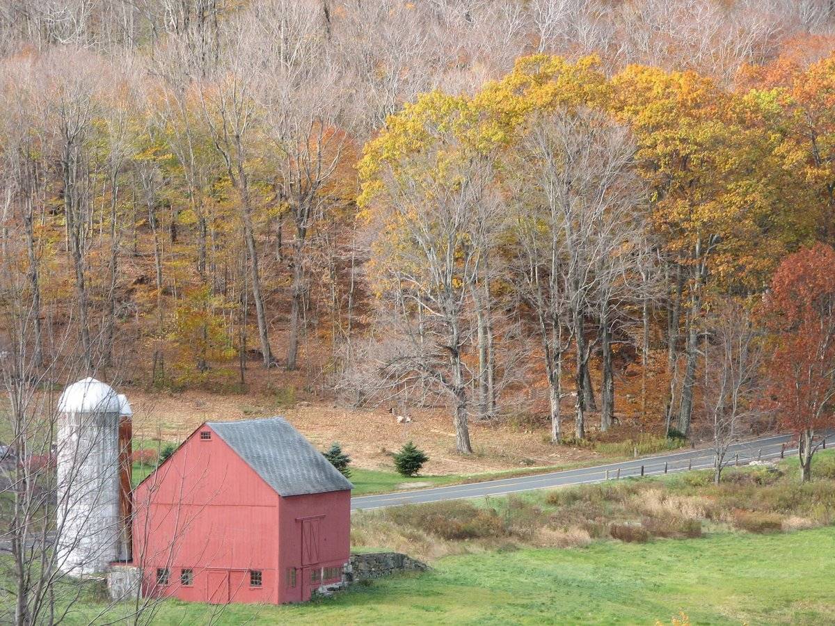
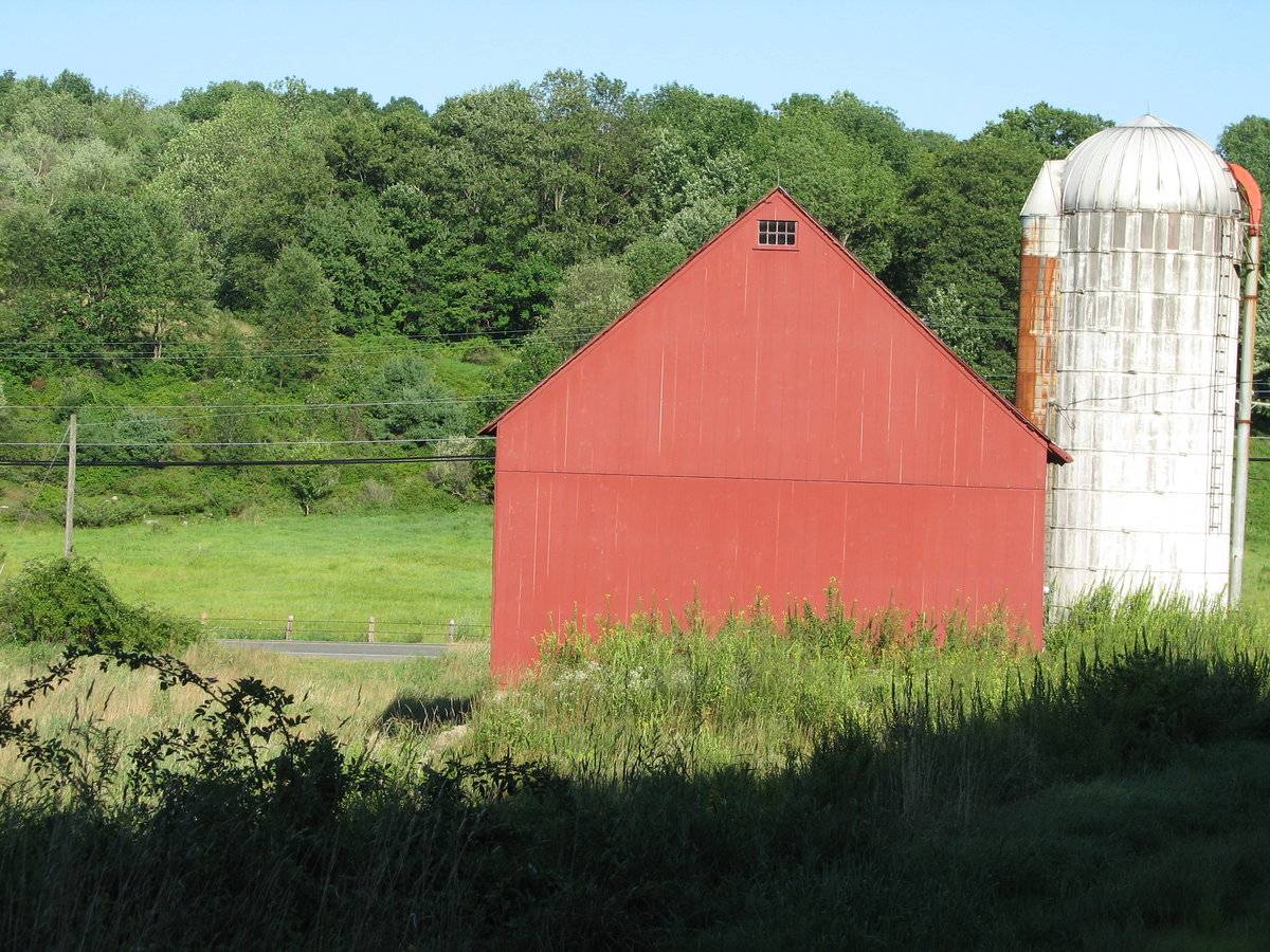
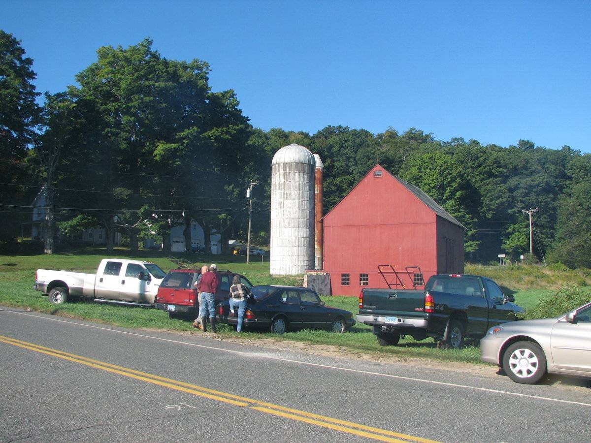
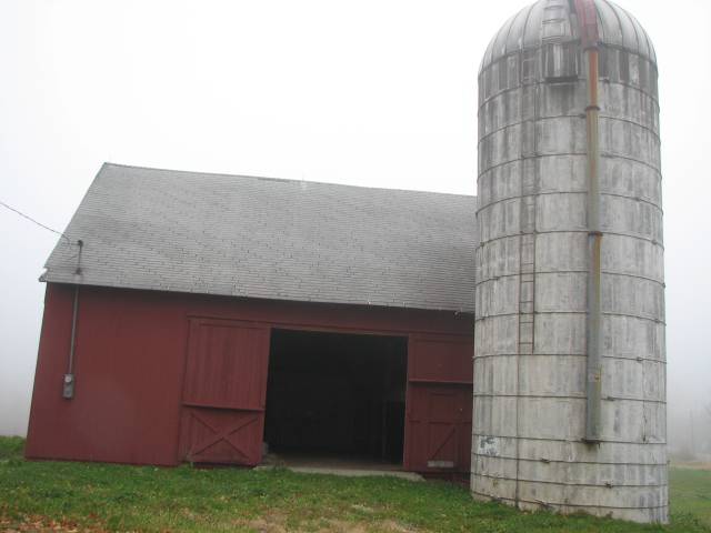
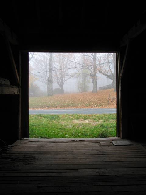
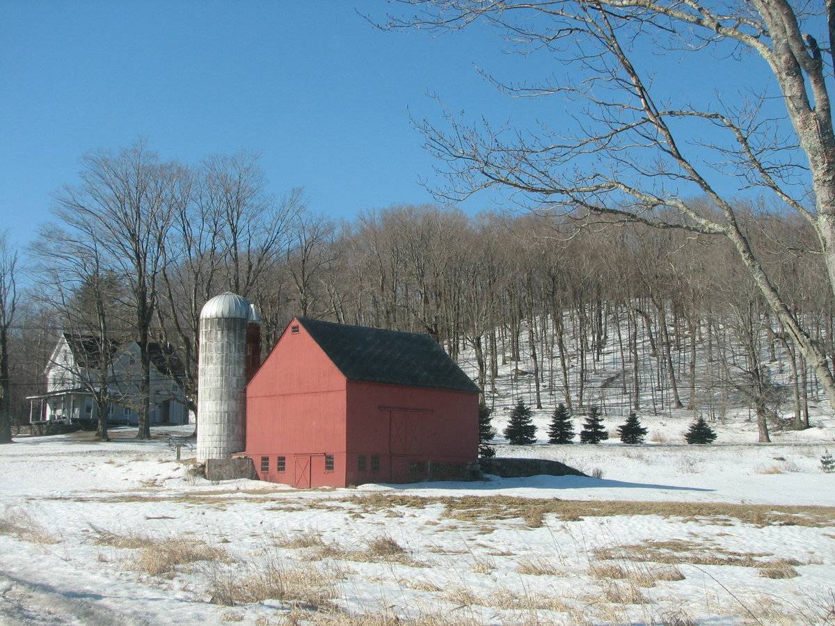
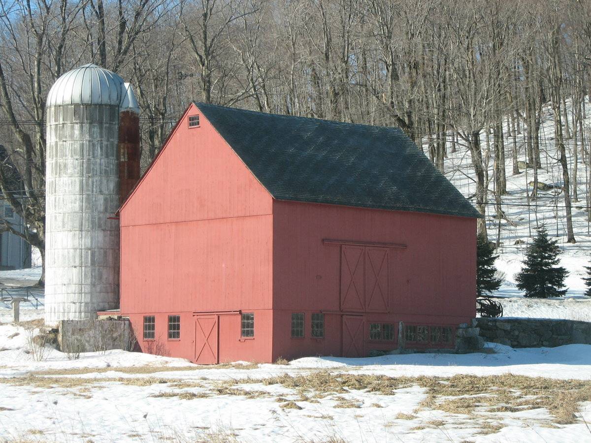
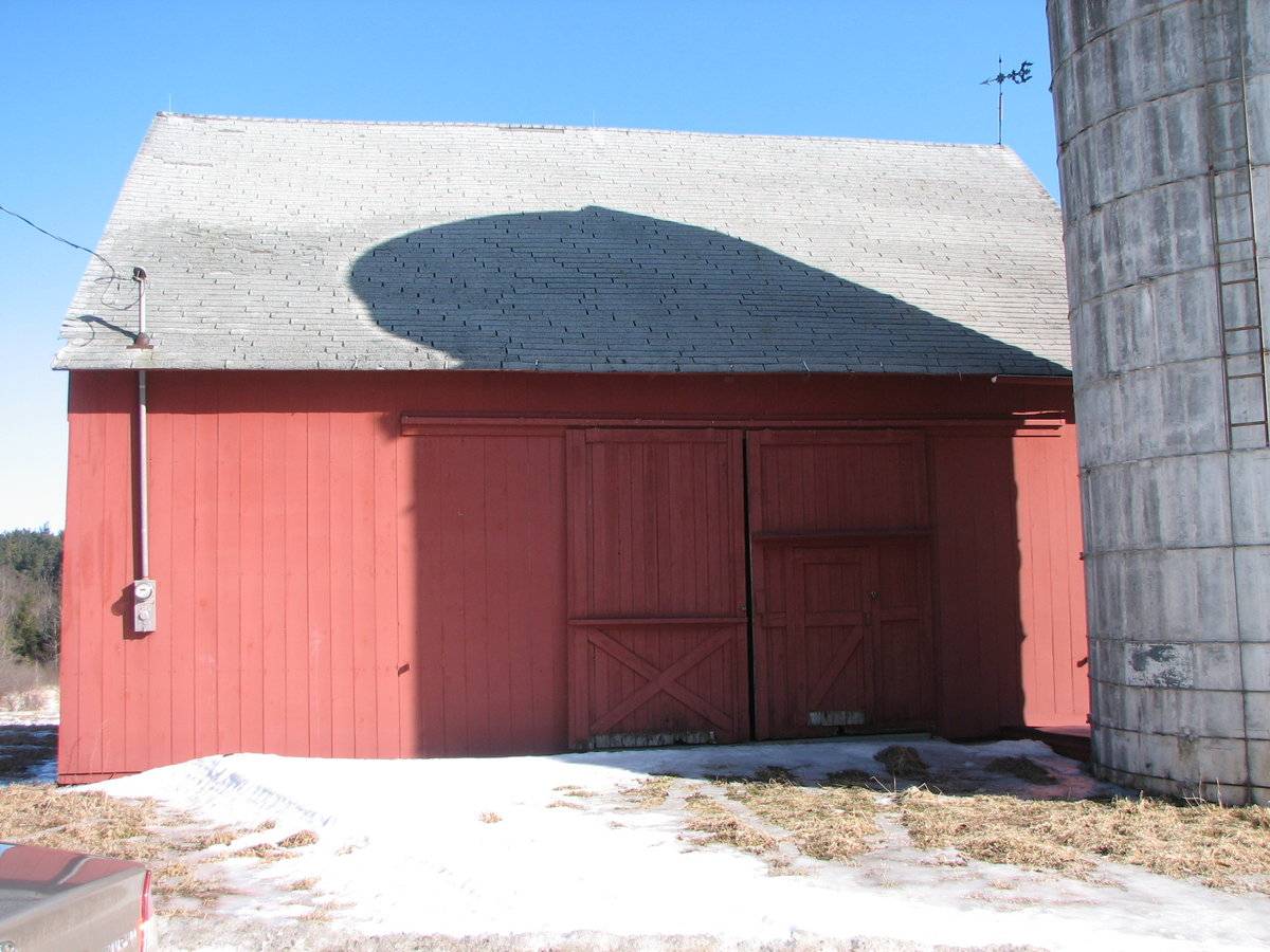
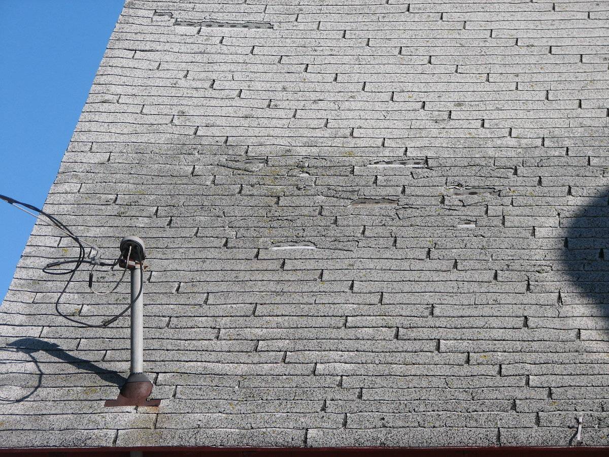
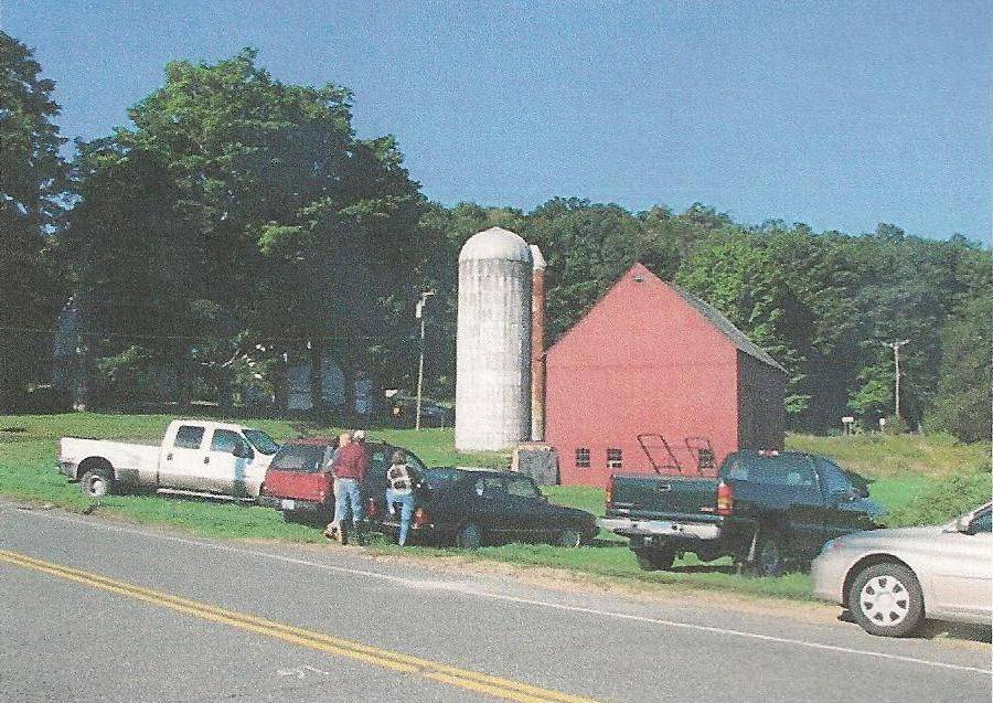
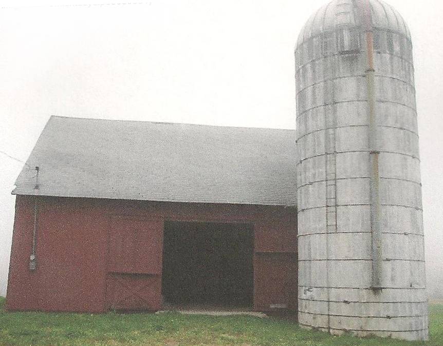
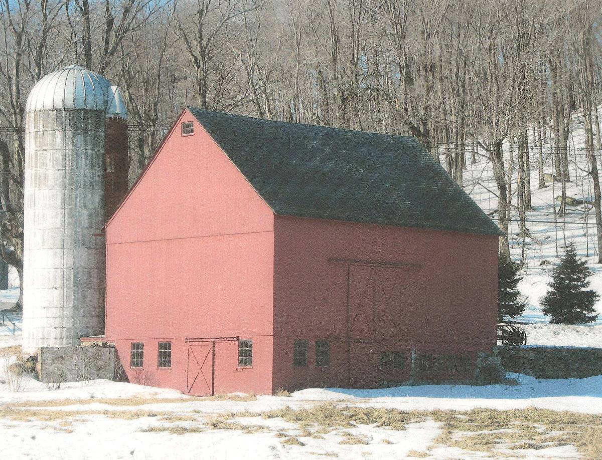
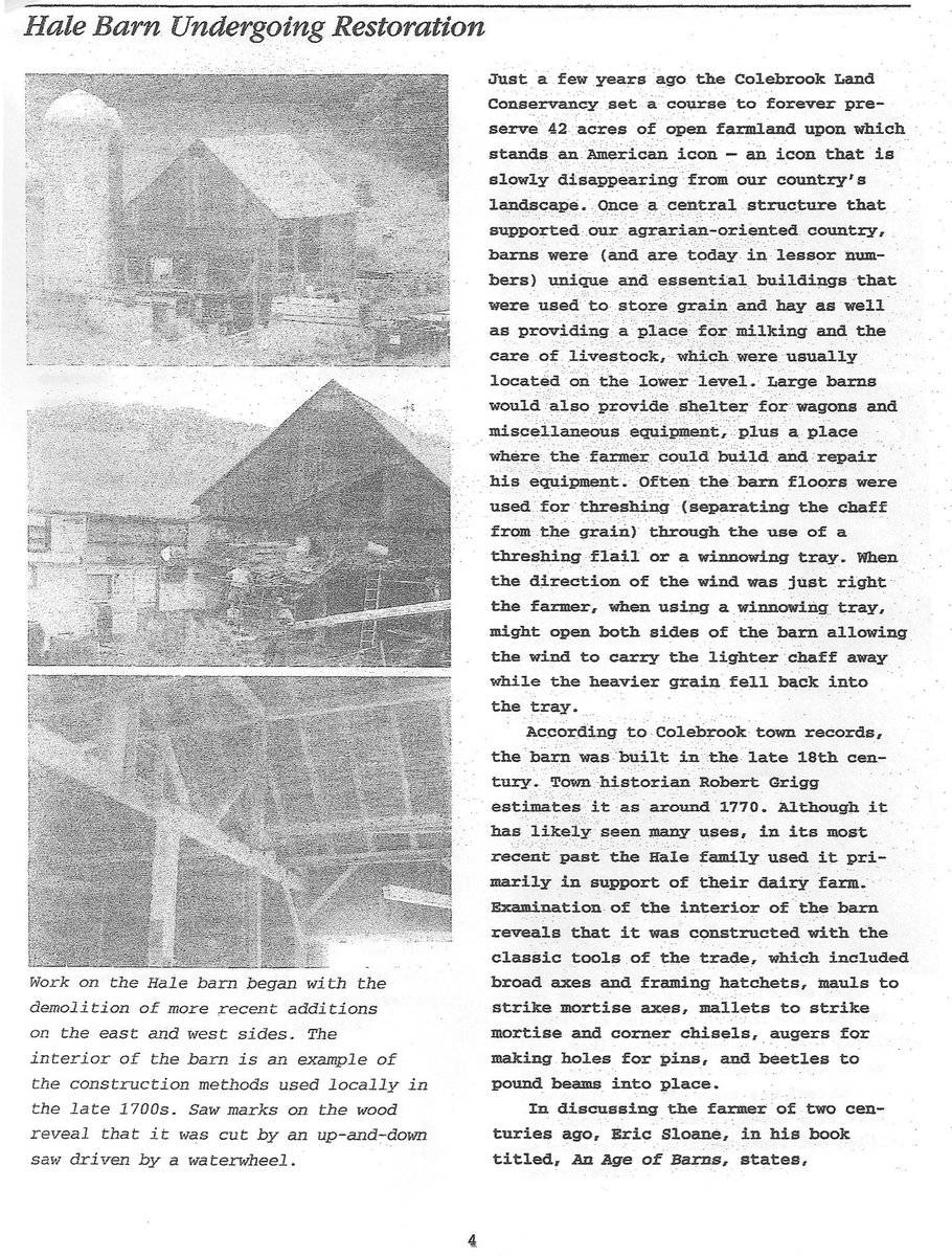
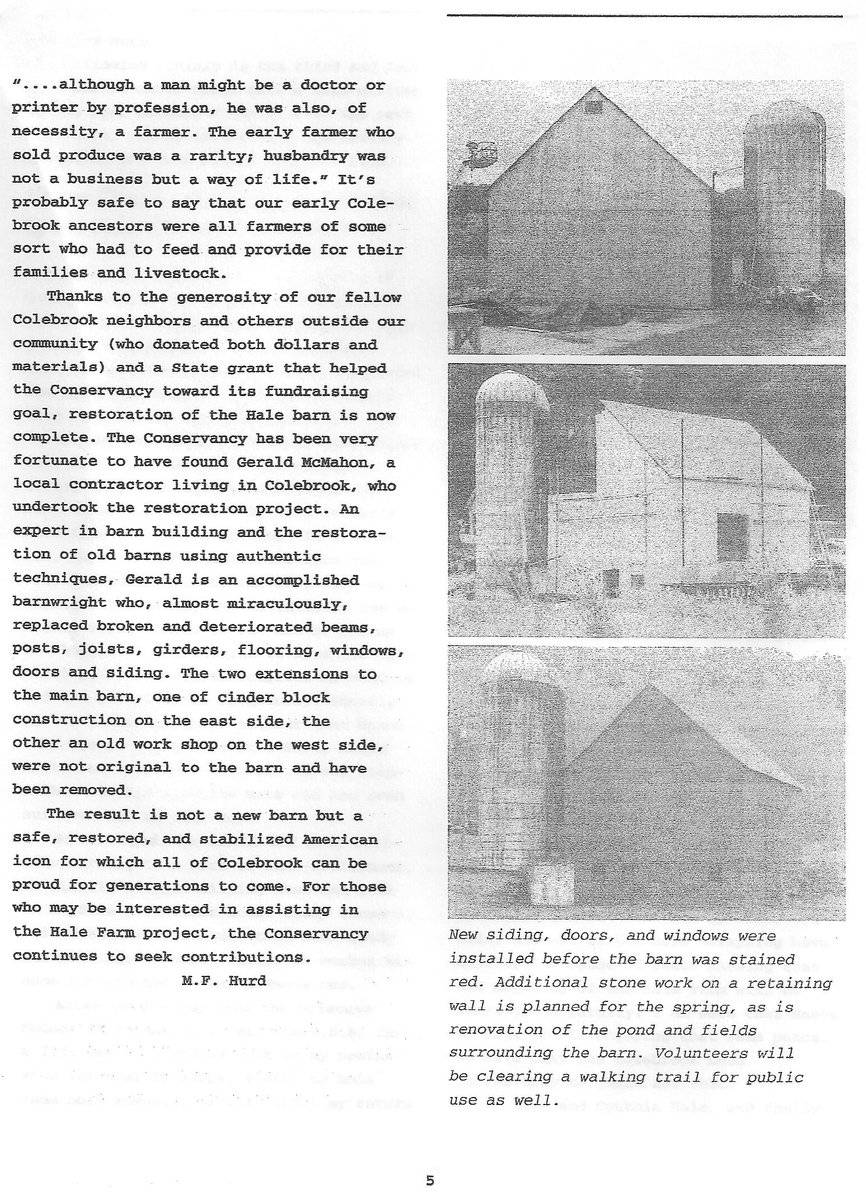
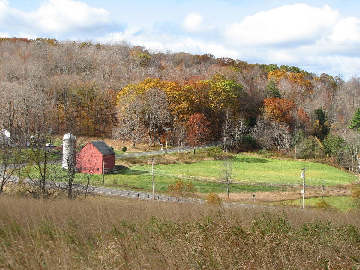
This is a 1 ½-story, tripartite, eave-entry bank barn. The main facade faces south and the ridge-line of the barn is roughly parallel to this portion of Stillman Hill Road, which runs approximately east-west. The main entry is a pair of exterior sliding doors in the center of three bays. The east leaf has a weather door with a hood. The west leaf has a X-brace in bottom portion. A poured cement silo is attached to the bottom of the east bay of the south eave-façade. The rest of the façade is blank. The grade at the southeast corner declines sharply, revealing a basement level in the east gable-end of the barn. A retaining wall extends to the east from the southeast corner. The basement level of the east gable-end of the barn has an X-braced sliding pass-through door flanked by nine-pane windows. A third nine-pane window is between the south corner and the southernmost flanking window. The rest of the east gable-end of the barn is blank except of an eight-pane window just beneath the apex of the roof. The basement level of the north eave-side of the barn has two nine-pane windows towards the east corner. Just to the west of those is an X-braced sliding pass-through door. To the west of the door are two sets of windows: the closest is a set of two nine-pane windows and the other is a set of four nine-pane windows. At the west corner of the basement level of the north eave-side of the barn is an exposed portion of the field-stone foundation. A stone retaining wall extends to the north from the northwest corner. The grade at the west gable-end of the barn increases sharply to the main level. The west gable-end of the barn is blank except of an eight-pane window just beneath the apex of the roof. The barn has vertical flush-board siding painted red. The roof is covered in split cedar shake. The foundation is mortared field-stone.
Historical significance:The oldest barns still found in the state are called the ““English Barn,” “side-entry barn,” “eave entry,” or a 30 x 40. They are simple buildings with rectangular plan, pitched gable roof, and a door or doors located on one or both of the eave sides of the building based on the grain warehouses of the English colonists’ homeland. The name “30 by 40” originates from its size (in feet), which was large enough for 1 family and could service about 100 acres. The multi-purpose use of the English barn is reflected by the building’s construction in three distinct bays - one for each use. The middle bay was used for threshing, which is separating the seed from the stalk in wheat and oat by beating the stalks with a flail. The flanking bays would be for animals and hay storage.
The 19th century saw the introduction of a basement under the barn to allow for the easy collection and storage of a winter’s worth of manure from the animals sheltered within the building. The bank barn is characterized by the location of its main floor above grade, either through building into a hillside or by raising the building on a foundation. This innovation, aided by the introduction of windows for light and ventilation, would eventually be joined by the introduction of space to shelter more animals under the main floor of the barn.
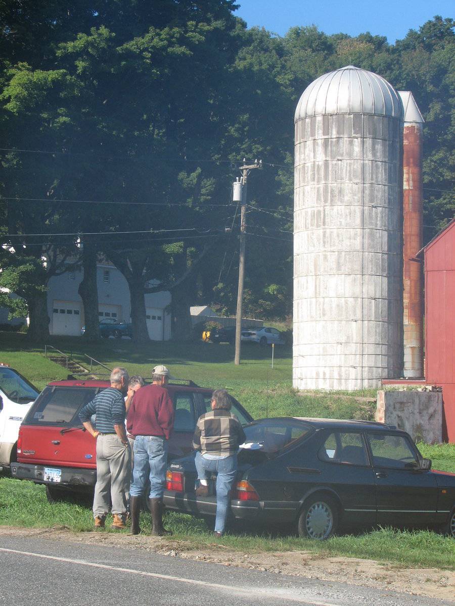
As with wooden stave silos, the concrete stave silo structures are held together with adjustable steel hoops, spaced about fifteen inches apart. Since concrete does not expand and contract with changes in moisture levels, the hoops on concrete stave silos were usually tightened only once after the structure was built. Inside, these silos are coated with a cement wash.
Field Notes
Listed on the State Register of Historic Places 6/04/2014. 2009 Barns Grant recipient for roof replacement. Restoration work in 2003; stable barn addition removed from east side.
- Use & Accessibility
Use (Historic)
Use (Present)
Exterior Visible from Public Road?
1
Demolished
n/a
Location Integrity
Original Site
- Environment
Related features
Environment features
Relationship to surroundings
The barn sits alone on the 42 acres site, just to the northwest of the intersection of Route 182 and Route 183. To the west and north of the barn are tracts of open space. To the northwest of the barn is a small body of water. The rest of the site is woodland. The area surrounding the site is scattered residential, open space, active agriculture and woodland.
MBLU : 15/ / 04/ / /
- Typology & Materials
-
Building Typology
Materials
Structural System
Roof materials
Roof type
Approximate Dimensions
40 ft x 36 ft
- Source
-
Date Compiled
11/17/2010
Compiled By
Todd Levine, reviewed by the Connecticut Trust
Sources
Photographs by Manuel Cords, 3/14/2009.
Map of Colebrook, CT, retrieved on November 17, 2010 from website www.zillow.com.
Sexton, James, PhD; Survey Narrative of the Connecticut Barn, Connecticut Trust for Historic Preservation, Hamden, CT, 2005, http://www.connecticutbarns.org/history.
Visser, Thomas D., Field Guide to New England Barns and Farm Buildings, University Press of New England, 1997.
Vision Appraisal Online Database. www.visionappraisal.com/colebrookct.
- PhotosClick on image to view full file
-